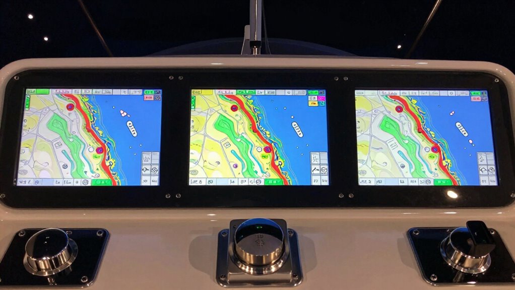
Choosing the right marine chartplotter with AIS integration depends heavily on your specific boating style and navigation needs. For those seeking an all-in-one solution, the Simrad GO9 stands out for its combination of GPS, sonar, and radar. If detailed underwater imaging and advanced mapping are priorities, the Garmin GPSMAP 943xsv offers high-definition sonar and pre-loaded charts. Meanwhile, the Garmin GPSMAP 1243xsv provides a larger display and comprehensive sonar support for serious anglers. Each of these options balances functionality, ease of use, and price differently—so understanding their strengths and tradeoffs is key to making the right choice.
Complete the kit


Key Takeaways
- The Simrad GO9 offers a versatile all-in-one setup, ideal for boaters who want integrated radar and sonar but requires additional hardware for full radar capabilities.
- The Garmin GPSMAP 943xsv excels at detailed underwater imaging with high-definition sonar and pre-loaded maps, suited for anglers and advanced navigators.
- Larger displays like the GPSMAP 1222xsv and 1243xsv provide better visibility at a glance, especially useful on larger vessels or for complex navigation.
- Price and complexity vary widely; high-end models include advanced features that may require a learning curve, while more straightforward options suit beginners better.
- All options support AIS integration, but the extent of features and ease of use differ, making some choices better for experienced users and others for newcomers.
| Simrad GO Chartplotter and Fish Finder with Transducer and Radar Options |  | Best Overall Multi-Function Marine Chartplotter | Display: Multifunction display with GPS, sonar, and radar support | Chart Card: C-MAP DISCOVER with Vector Charts, Bathymetric contours, Tides & Currents | Sonar: Active Imaging 3-in-1 with CHIRP, SideScan, DownScan, FishReveal | VIEW ON AMAZON | See Our Full Breakdown |
| Garmin GPSMAP 943xsv 9″ Chartplotter Fishfinder with SideVü and ClearVü Chirp, Touchscreen, Built-in Navionics Plus |  | Best for Detailed Underwater Imaging & User-Friendly Interface | Display: 9-inch touchscreen | Sonar Support: SideVü, ClearVü, traditional Chirp | Pre-loaded Maps: Navionics Plus | VIEW ON AMAZON | See Our Full Breakdown |
| GPSMAP 1222xsv 12″ MFD with Sonar and Basemap |  | Best Large Display for Navigation and Fishing | Display Size: 12 inches | Features: MFD, Sonar, Basemap | Mapping: Preloaded Basemap | VIEW ON AMAZON | See Our Full Breakdown |
| Garmin ECHOMAP UHD2 94sv with GT56 Transducer, 9″ Touchscreen Chartplotter, Navionics+ U.S. Coastal |  | Best Bright Display & Coastal Mapping | Display: 9-inch touchscreen | Transducer: GT56-TM | Charts: Navionics+ U.S. Coastal | VIEW ON AMAZON | See Our Full Breakdown |
| Garmin GPSMAP 1243xsv 12-Inch Chartplotter Fishfinder with Navionics Plus |  | Best for Large Screen & Advanced Imaging | Display: 12.1-inch touchscreen | Sonar: Panoptix, SideVü, ClearVü, Chirp | Charts: Navionics Plus | VIEW ON AMAZON | See Our Full Breakdown |
| marine chartplotter with ais integration | Display | Connectivity |
|---|---|---|
| Simrad GO Chartplotter and Fis | Multifunction display with GPS, sonar, and radar support | NMEA 2000, smartphone/tablet mirroring |
| Garmin GPSMAP 943xsv 9" Chartp | 9-inch touchscreen | Wi-Fi |
| GPSMAP 1222xsv 12" MFD with So | — | — |
| Garmin ECHOMAP UHD2 94sv with | 9-inch touchscreen | Wi-Fi |
| Garmin GPSMAP 1243xsv 12-Inch | 12.1-inch touchscreen | — |
More Details on Our Top Picks
Simrad GO Chartplotter and Fish Finder with Transducer and Radar Options
The Simrad GO9 combines GPS, sonar, and radar support into a single multifunction display, making it a versatile choice for both navigation and fishing. It includes the C-MAP Discover charts, which cover US and Canadian waters with detailed bathymetric contours and tide data. Its active imaging 3-in-1 sonar provides exceptional underwater views, especially for anglers. However, the setup can be complex, and full radar functionality requires additional hardware, which could increase costs. Compared to simpler units, it offers a comprehensive ecosystem but at the expense of a steeper learning curve.
Pros:- All-in-one GPS, sonar, and radar support
- Includes detailed C-MAP Discover charts
- Supports Active Imaging 3-in-1 sonar for fishing
Cons:- Requires extra radar hardware for full radar capabilities
- Complex installation and setup process
Best for: Advanced boaters seeking an integrated navigation, radar, and sonar system for versatile use.
Not ideal for: Beginners or boaters looking for a plug-and-play solution without additional hardware investments.
- Display:Multifunction display with GPS, sonar, and radar support
- Chart Card:C-MAP DISCOVER with Vector Charts, Bathymetric contours, Tides & Currents
- Sonar:Active Imaging 3-in-1 with CHIRP, SideScan, DownScan, FishReveal
- Connectivity:NMEA 2000, smartphone/tablet mirroring
- Radar Compatibility:Supports Simrad radar solutions
Our verdict“This model is best suited for experienced boaters wanting a complete, integrated system that covers navigation, fishing, and radar, accepting the higher setup complexity.”
The Garmin GPSMAP 943xsv offers a 9-inch touchscreen with high-definition sonar imaging, including SideVü, ClearVü, and traditional Chirp. It comes with pre-loaded Navionics Plus maps, making navigation straightforward. Its support for Panoptix sonar adds versatility for scanning in multiple directions. The interface is intuitive, perfect for boaters who want detailed underwater views without a complicated setup. The main tradeoff is its high cost, which might deter less committed users, and the feature set could be overwhelming for beginners.
Pros:- High-definition sonar with SideVü and ClearVü
- Pre-loaded Navionics Plus maps
- Touchscreen interface for ease of use
Cons:- Higher price point
- Learning curve due to advanced features
Best for: Anglers and boaters who prioritize detailed sonar imaging combined with easy-to-use navigation.
Not ideal for: Budget-conscious users or those new to marine electronics who prefer simpler devices.
- Display:9-inch touchscreen
- Sonar Support:SideVü, ClearVü, traditional Chirp
- Pre-loaded Maps:Navionics Plus
- Features:Panoptix sonar support, high-def scanning
- Connectivity:Wi-Fi
Our verdict“Ideal for experienced boaters seeking high-detail underwater imaging and integrated navigation in a user-friendly package, despite the higher cost.”
GPSMAP 1222xsv 12″ MFD with Sonar and Basemap
The GPSMAP 1222xsv features a spacious 12-inch display, making it easier to view detailed maps and sonar data at a glance. Its integrated sonar supports multiple frequencies, and preloaded Basemap provides detailed navigation contours. It’s a straightforward solution for anglers and navigators who prefer a larger screen without the fuss of overly complex features. Its main restriction is the lack of detailed specifications compared to more advanced models, and without known user ratings, it’s harder to assess its overall performance in real-world conditions.
Pros:- Large 12-inch display for better visibility
- Integrated sonar support
- Preloaded Basemap for navigation
Cons:- Limited detailed specs in available info
- Potentially higher price for size
Best for: Large vessel operators or those needing a bigger screen for complex navigation and fishing.
Not ideal for: Budget-conscious users or those seeking the most feature-rich or compact options.
- Display Size:12 inches
- Features:MFD, Sonar, Basemap
- Mapping:Preloaded Basemap
Our verdict“Best suited for boaters who value a large, clear display for navigation and fishing but do not require the most advanced technology or extensive feature set.”
Garmin ECHOMAP UHD2 94sv with GT56 Transducer, 9″ Touchscreen Chartplotter, Navionics+ U.S. Coastal
The Garmin ECHOMAP UHD2 94sv offers a bright, sunlight-readable 9-inch touchscreen combined with advanced scanning sonar, including SideVü, ClearVü, and traditional Chirp, thanks to the GT56 transducer. It includes detailed Navionics+ U.S. Coastal charts and Wi-Fi connectivity for wireless data sharing. Its vivid display and coastal focus make it ideal for boaters in U.S. waters, especially those who need clear visibility in bright conditions. Its main drawback is the higher price for its advanced features, and some users may find their learning curve steep if unfamiliar with marine electronics.
Pros:- Sunlight-readable, bright display
- Includes advanced sonar with GT56 transducer
- Built-in Navionics+ U.S. Coastal charts
Cons:- Higher cost for advanced features
- Requires familiarity with marine electronics
Best for: Coastal boaters who need a bright display and detailed mapping for navigation and fishing.
Not ideal for: Inshore or inland boaters who do not require coastal charts or advanced sonar features.
- Display:9-inch touchscreen
- Transducer:GT56-TM
- Charts:Navionics+ U.S. Coastal
- Connectivity:Wi-Fi
Our verdict“Excellent for coastal navigation and fishing with a focus on visibility and detailed sonar imaging, though at a premium price point.”
Garmin GPSMAP 1243xsv 12-Inch Chartplotter Fishfinder with Navionics Plus
The GPSMAP 1243xsv combines a massive 12.1-inch touchscreen with support for multiple sonar technologies, including Panoptix, SideVü, ClearVü, and traditional Chirp. It’s designed for serious anglers and navigators who need detailed imaging and extensive mapping capabilities. Its waterproof IPX7 rating adds durability for challenging marine conditions. The main challenge lies in its complexity; setting up and mastering all features may require technical knowledge, making it less suitable for casual boaters.
Pros:- Large 12.1-inch high-definition touchscreen
- Supports Panoptix, SideVü, ClearVü, Chirp
- Preloaded Navionics Plus charts
Cons:- High price point
- Complex setup and operation
Best for: Experienced anglers and navigators needing a large display with extensive sonar and mapping options.
Not ideal for: Beginners or casual users looking for simple, straightforward devices.
- Display:12.1-inch touchscreen
- Sonar:Panoptix, SideVü, ClearVü, Chirp
- Charts:Navionics Plus
- Waterproof:IPX7
Our verdict“Best for seasoned users who want a large, detailed screen with versatile sonar options, accepting the learning curve involved.”

How We Picked
Our selection process focused on marine chartplotters that combine AIS functionality with robust navigation features suitable for a variety of boaters in 2026. We prioritized models with high-quality displays, detailed mapping, and sonar capabilities, ensuring they support AIS for collision avoidance and traffic monitoring. We considered user reviews, feature sets, and overall value—balancing advanced tech with ease of use. Price range and hardware complexity also influenced rankings, aiming to recommend options for both seasoned mariners and casual boaters alike.
| marine chartplotter with ais integration | Connectivity |
|---|---|
| Simrad GO Chartplotter and Fis | NMEA 2000, smartphone/tablet mirroring |
| Garmin GPSMAP 943xsv 9" Chartp | Wi-Fi |
| GPSMAP 1222xsv 12" MFD with So | — |
| Garmin ECHOMAP UHD2 94sv with | Wi-Fi |
| Garmin GPSMAP 1243xsv 12-Inch | — |
Factors to Consider When Choosing Marine Chartplotter With Ais Integration
Selecting the right marine chartplotter with AIS integration hinges on understanding your primary needs—whether that’s detailed sonar imaging, large display size, or integrated radar support. Consider your experience level, boat size, and budget to match the device’s complexity and features. Compatibility with existing equipment and ease of use are also critical, especially if you prefer straightforward operation over advanced customization.Key Features to Consider
Focus on display size and resolution, sonar support (including SideVü, ClearVü, and traditional Chirp), pre-loaded maps, and AIS integration. Larger screens improve visibility on bigger vessels, while detailed sonar benefits anglers. AIS capabilities enhance safety by showing nearby vessels and traffic.
Complexity vs. Usability
High-end models like the Garmin GPSMAP 1243xsv and Simrad GO9 offer extensive features but may require a learning curve. Simpler units or those with touchscreen interfaces tend to be more accessible for beginners, though they might lack some advanced capabilities.
Budget Considerations
More advanced devices generally come with higher price tags. Balance your budget with the features you need most—sometimes paying extra for detailed sonar or larger displays makes sense if those are priorities for your boating activities.
Frequently Asked Questions
What is AIS integration, and why is it important for marine chartplotters?
AIS, or Automatic Identification System, allows your chartplotter to receive real-time information about nearby vessels, including their position, speed, and heading. It enhances safety by helping you avoid collisions and navigate crowded waterways with better awareness of surrounding traffic. For boaters in busy or high-traffic areas, AIS integration is a valuable feature that can significantly improve situational awareness.
How does sonar support improve navigation and fishing?
Advanced sonar capabilities like SideVü, ClearVü, and traditional Chirp provide highly detailed underwater images. These features help identify fish, underwater structures, and the seabed with clarity, making them especially useful for anglers. For navigation, detailed sonar complements chart data by revealing underwater hazards and features that might not be on maps, increasing safety and precision.
Are larger screens always better for marine chartplotters?
Larger screens, such as 12-inch displays, improve visibility and allow for more detailed views of charts and sonar data. However, they can also be more expensive, heavier, and less portable. The ideal size depends on your vessel size, workspace, and whether you prioritize easy readability or portability. For larger boats or complex navigation, bigger screens often provide a tangible benefit.
Is a touchscreen interface preferable for marine electronics?
Touchscreens simplify operation by offering intuitive controls and quick access to features. They are especially handy for adjusting settings on the fly. However, in rough seas or bright sunlight, tactile buttons may sometimes be more reliable. Your preference depends on how comfortable you are with touch controls and your typical boating environment.
What should I consider regarding price and future upgrades?
High-end models with advanced features tend to be more expensive but offer greater flexibility for future upgrades. Consider whether the device supports additional modules like radar or AIS upgrades. It’s also wise to evaluate the manufacturer’s support and software update policies to ensure your investment remains valuable over time.
Conclusion
For boaters new to marine electronics or those seeking straightforward, reliable navigation, models like the Garmin ECHOMAP UHD2 94sv provide excellent value with user-friendly features. Experienced anglers or navigators who want detailed sonar imaging and larger displays should lean toward the Garmin GPSMAP 1243xsv or the Simrad GO9, despite their complexity. Casual boaters operating in coastal waters might find the Garmin GPSMAP 943xsv ideal for its balance of features and ease of use. Ultimately, your choice depends on your specific priorities—whether that’s advanced imaging, ease of operation, or integrated radar and AIS support.