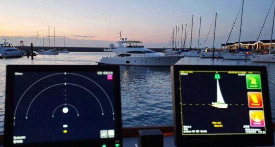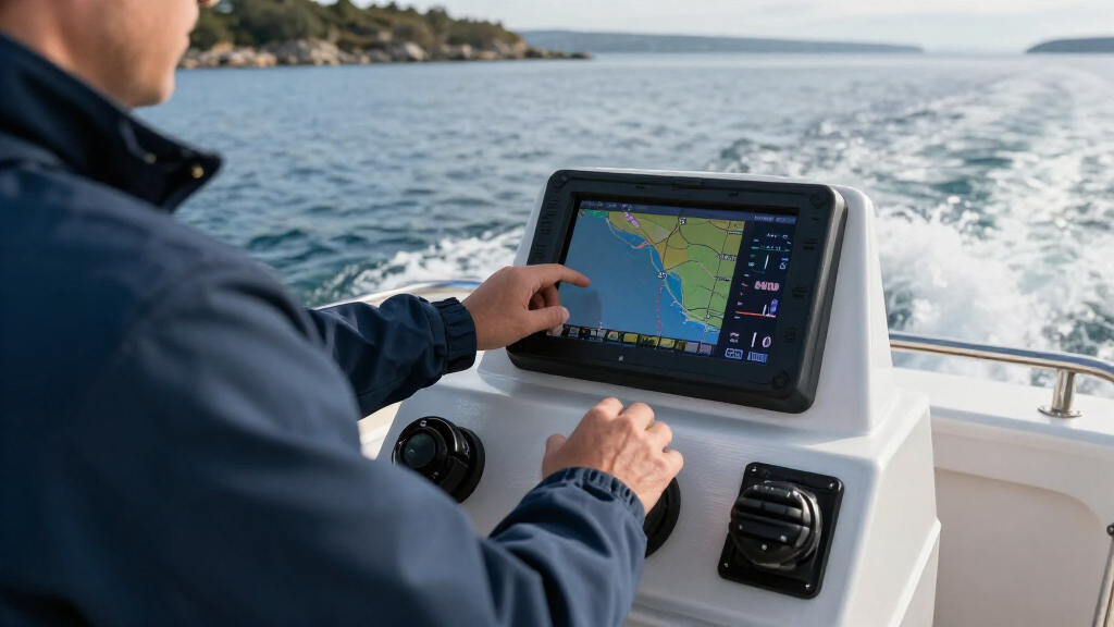

TL;DR
Marine electronics for boats include navigation, communication, depth, collision-awareness, and monitoring equipment. Start with the needs of your boat and operating area, check compatibility and installation requirements before buying, and keep backup skills and methods ready because electronics support seamanship rather than replace it.
A bright chartplotter can put your boat’s position, a marked channel, and nearby traffic on one screen. But if its power cable loosens in choppy water, that polished display can go dark in a moment. Marine electronics for boats are most useful when you understand what each instrument does and have a sensible plan for faults.

Get sports gear delivered free with Prime
- Fast, free delivery on millions of items
- Prime Video, Amazon Music and more included
- Member-only deals all year
This guide explains how navigation, depth sounders, VHF radios, radar, AIS, and connected systems work together. You’ll see why a small inland boat may need a simpler setup than an offshore cruiser, how installation affects performance, and what to check before you buy. The goal is a boat you can operate confidently in bright sun, rain, and the occasional screen failure.
There is no universal package that fits every boat. A weekend angler crossing a familiar lake has different needs from a crew running a coastal passage after sunset. Start with the waters you travel, the people aboard, and the conditions you expect; then choose equipment you can actually use.
Choose equipment around your operating area, trip length, crew, and local rules.
A GPS receiver supplies position; a chartplotter adds electronic chart display and may combine other data.
Radar detects reflected objects, while AIS depends on participating vessels transmitting information.
Check exact model and feature compatibility before connecting equipment across brands.
Inspect installation and power, keep charts maintained, and preserve backup navigation and communication skills.
Choose the Gear That Fits Your Boat and Your Trips
Marine electronics for boats should match your boat’s size, operating area, typical trips, and crew experience. A small inland runabout may get real value from a chart display, depth sounder, and suitable radio, while an offshore boat may need radar, AIS, satellite communications, and more robust backups. Start with where you go and what could make a trip difficult.
Imagine you fish a familiar lake on sunny afternoons. A readable chart display and depth information may answer your daily questions better than a large radar installation. Now picture a coastal passage in fog, with commercial traffic and a crew on watch: radar and AIS can add useful information, although neither replaces a proper lookout or guarantees collision avoidance.
Use this simple buying sequence before comparing brands:
- List your trips. Note where you travel, how far from help you go, and whether you go out at night or in poor visibility.
- Write down your needs. Include navigation, communication, depth awareness, collision information, and engine or battery monitoring.
- Check local requirements. Radio licensing, equipment rules, and recommended safety gear vary by country and operating area.
- Plan installation and backup. Account for power, antennas, sensors, mounting, and what you’ll use if a display fails.
For a new owner, a qualified instructor can help build practical navigation and radio skills. Learn the basics before adding complex features; a familiar tool is easier to use when rain taps the cabin windows and the boat is rolling.
Popular right now

Vitamix 5200 Blender with 64 oz Container, Black

Roborock Q7 M5+ Robot Vacuum and Mop

TCL 55-Inch T7 Series 4K QLED Smart Google TV (55T7)
As an affiliate, we earn on qualifying purchases.
Know What a Chartplotter Adds to a GPS Position
A GPS receiver estimates your position; a chartplotter places that position on an electronic chart and may show routes, waypoints, and other instrument data. That difference matters when you buy equipment: a position by itself does not show the channel, the shoal, or the safe route home. The chart, sensors, power, and your interpretation all play a part.
On a familiar harbor approach, a chartplotter might display your boat moving along a saved route as depth readings appear beside it. Some systems can also put radar returns or AIS targets on the same screen. These layers can make information easier to compare, like several windows opening onto the same stretch of water, but they do not make every mark correct or every hazard visible.
Electronic charts are aids, not a reason to abandon backup methods. Keep suitable paper charts or another backup appropriate to your trip, and learn how to use them. Check chart coverage and updates for your area; software can’t compensate for an outdated or unsuitable chart. If a screen freezes in a narrow channel, your crew will have more options if someone can still identify landmarks and follow a basic bearing.
Keep a human lookout. A chart shows mapped information and estimated position. Your eyes, local knowledge, and sound judgment still matter on the water.
Before departure, zoom into the route, confirm waypoints, and compare the planned path with conditions and known hazards. A route line is a plan to check, not an instruction to follow blindly.
Get Useful Depth Readings Without Guessing at the Sonar
A depth sounder uses sonar to measure water depth, while fish-finding sonar adds displays and processing intended to help interpret objects below the boat. Some units combine both jobs, but chart navigation and sonar readings remain different functions. The reading you see depends on the device, settings, transducer, and how the boat is moving.
Those differences matter because a chart and a sounder answer different questions. A chart helps you plan over a wider area using mapped depths; a sounder reports what its transducer detects beneath the boat now. If your displayed depth conflicts with the chart, treat the disagreement as a reason to slow down and investigate. The chart may be old or based on a different reference level, while the sounder may be affected by its installation, settings, or motion. Neither reading alone proves that the water ahead is clear.
Consider an angler heading into an unfamiliar cove. The chartplotter shows mapped contours, while the sounder reports depth directly beneath the transducer. If the depth suddenly drops as the boat crosses a shelf, that live change can help the skipper decide to turn or reduce speed before reaching shallower water. But the sounder samples a limited area under the hull; it may reveal a hazard only as the boat approaches it, and it cannot show the whole route. Draft, tide, and the space needed to maneuver therefore still matter when judging a reading.
Transducer placement strongly affects performance. A poorly positioned sensor can sit in disturbed water, lose readings at speed, or show noise that makes the screen look like a snowstorm. Losing a reading at speed can leave you without useful warning when the boat is moving fastest, so check performance at the speeds you actually travel. Follow the equipment maker’s placement guidance and account for the hull shape, propeller flow, and installation angle. For a trailer boat, ask an installer to check clearance and cable routing before drilling into the hull.
Use depth alarms thoughtfully, especially in unfamiliar water, and account for draft, tide, and a safety margin. An alarm set too close to the boat’s draft may sound only when there is little time to react; set too conservatively, it may become so frequent that the crew starts ignoring it. For example, a sailboat drawing five feet of water should not treat a five-foot display reading as comfortable clearance. Read the unit’s manual, learn what its colors and symbols mean, and compare the screen with the chart and conditions around you.
Set Up Your VHF Radio and DSC Before You Need Them
A fixed VHF radio lets you communicate with other vessels and shore stations; Digital Selective Calling, or DSC, can send a digital alert that includes boat identity and position when it is properly configured and connected to a valid position source. A radio with an unprogrammed identity or no position feed may not provide the alert information you expect. Rules and licensing differ across locations, so check your local requirements.
Take a small coastal boat leaving a crowded harbor on a foggy morning. The skipper has a fixed radio with an external antenna and a handheld radio stored as a backup. Before departure, the crew knows which channel to use for routine calls and how to make a distress call. That preparation matters more than having a radio buried under a pile of wet jackets.
Test the setup before the trip. Confirm that the radio displays a position, that DSC identity programming is correct, and that the antenna and power connections are secure. Follow the maker’s instructions and local rules when testing or making calls; don’t trigger a distress alert as a casual test. A fixed unit generally provides more power and uses an external antenna, while a handheld offers portability and can serve as backup.
Keep the microphone reachable and show every regular crew member the basic controls. In an emergency, someone else may need to call for help. Practice can turn a confusing row of buttons into a familiar tool, like knowing where the flashlight sits before the cabin goes dark.
Use Radar and AIS as Different Views of Nearby Traffic
Radar detects reflected radio waves; AIS receives information sent by participating vessels. They answer different questions, so one does not replace the other. Radar can show many objects that do not transmit AIS, while AIS can identify a transmitting vessel and share information such as its reported position and movement.
Here’s how the two can help on a night passage near a shipping lane:
| System | What it provides | Limit to remember |
|---|---|---|
| Radar | Returns from objects that reflect its radio signal, shown by range and bearing. | Returns can be hard to interpret; small or shielded targets may be missed, and setup matters. |
| AIS | Data from vessels transmitting compatible AIS information, often including identity and reported movement. | It depends on transmission and reception; not every vessel or hazard appears. |
| Visual lookout | Direct observation of vessels, lights, weather, and other conditions around you. | Visibility and attention can be limited, especially at night or in rain. |
A radar return could reveal a small boat that has no AIS transmitter; an AIS target could tell your crew which cargo ship is approaching. Comparing those clues with what you can see gives a fuller picture. But avoid treating a screen as a collision-avoidance machine: range, clutter, incorrect settings, and changing conditions can complicate the picture.
Take time to learn radar controls in safe conditions and set up alarms that suit your route. Good information only helps when the crew understands what the display shows and keeps watch.
Connect Displays Only After You Check Compatibility
Connected systems share data among compatible equipment, so one display may show position, depth, heading, radar, AIS targets, or engine readings. Networked instruments can help a crew monitor a boat without checking a separate screen for every reading. NMEA 2000 is a common marine data network, and Ethernet often carries higher-bandwidth information for devices such as some radar and sonar systems.
Suppose you already have a chartplotter from one brand and want to add an engine monitor from another. A shared connector or network label does not guarantee that the screen will show every data item. The specific models, supported protocols, software versions, and any required adapters all matter. Check compatibility documents for the exact equipment and features you plan to use before you buy.
Integration can simplify a helm, but it can also add setup work. If a crew member cannot find the depth alarm or radio information on a crowded multifunction display, the extra connections have made the boat harder to operate. A clear main screen and familiar controls may matter more than fitting every available data layer.
Write down the equipment model numbers and the data you want to share, then ask the manufacturer or a qualified installer to confirm the connection plan. Include cable runs, network power, and mounting space. This small bit of planning can prevent a costly surprise after the new display arrives and sits on the workbench.
Protect Power, Installation, and Backup Plans
Reliable marine electronics depend on reliable installation. Suitable power, circuit protection, cable routing, connectors, and protection from water, heat, and vibration all affect how equipment performs. A capable chartplotter can still reboot when a corroded connection interrupts power, or a radio can disappoint when its antenna installation is poor.
Picture a boat crossing a choppy bay: a loose battery connection cuts power just as the skipper checks the route. A well-secured cable, appropriate fuse, and clean connection can help prevent that simple fault. Follow the manufacturer’s wiring instructions, and get qualified help with high-current circuits, antennas, radar, or complex networks if the work is beyond your experience.
Before each trip, give the system a quick health check:
- Inspect visible power connections, cables, and antenna fittings for damage or corrosion.
- Confirm displays start, sensors return readings, and the radio has a position source where needed.
- Check that charts and software are maintained according to the manufacturer’s guidance.
- Carry backups suited to the route, such as a handheld radio, paper chart, compass, or independent light.
Make sure the screen is readable in sunlight and the controls are manageable in rough conditions. A complex helm can be like a cockpit full of blinking lights: impressive at the dock, confusing when spray hits the windshield. Learn the setup at home or in calm water, and make sure other regular crew know the basics too.
Frequently Asked Questions
What marine electronics do I need for my boat?
Start with the boat’s use, operating area, crew experience, and local rules. Many owners prioritize reliable navigation, a suitable VHF radio, and depth information, then add radar, AIS, or autopilot when their trips call for them.
What is the difference between a chartplotter and a GPS?
A GPS or other GNSS receiver estimates your position. A chartplotter places that position on an electronic chart and may combine it with routes, depth, radar, or AIS data.
Do I need a fish finder or just a depth sounder?
A depth sounder focuses on water depth, while fish-finding sonar adds tools that help interpret objects beneath the boat. The useful choice depends on your activity, transducer, and how you plan to use the readings.
Should I choose a fixed or handheld VHF radio?
A fixed radio generally offers more power and an external antenna, while a handheld is portable and can serve as a backup. Consider your boat, range needs, available mounting space, and local rules.
Is radar still useful if I have AIS?
Yes. Radar detects reflecting objects, while AIS shows data from vessels transmitting compatible signals. Each has limitations, so use them alongside a proper visual lookout.
Can I connect marine electronics from different brands?
Often, but a shared connector or network name does not mean every feature will work. Check the exact model compatibility, supported protocols, software versions, and any required adapters before buying.
Conclusion
Build your electronics setup around the trips you actually make, then learn each tool before the weather turns or a screen goes blank. Reliable wiring, a correctly configured radio, understandable displays, and suitable backups can matter as much as the device name on the box.
Choose a system your crew can use with wet hands and a steady head. On the water, the best screen is the one that helps you make a sound decision—and still leaves you ready when it goes dark.