To navigate a nautical chart confidently, start by familiarizing yourself with the legend that explains symbols, colors, and aids like buoys and lighthouses. Pay attention to depth contours, tidal information, and hazard symbols to understand underwater features and water levels. Use the compass rose and coordinate grid for precise positioning. By understanding these basics, you’ll feel more in control on the water—keep exploring, and you’ll gain even more confidence.
Key Takeaways
- Familiarize yourself with the chart legend to understand symbols, colors, and their meanings.
- Use the compass rose to orient the chart with true or magnetic north and account for declination.
- Identify navigational aids like buoys, lighthouses, and landmarks to confirm your position.
- Always check tide tables and water depths to avoid hazards and plan safe routes.
- Practice visualizing underwater features using depth contours and symbols to anticipate potential dangers.

Garmin 010-01550-00 Striker 4 with Transducer, 3.5" GPS Fishfinder with Chirp
Clear Vu scanning Sonar shows you more of what is in the water around your boat; This high...
As an affiliate, we earn on qualifying purchases.
What Is a Nautical Chart and Why Is It Essential for Safe Sailing

A nautical chart is a detailed map specifically designed for maritime navigation, showing water depths, coastlines, hazards, and navigational aids. Its history background dates back centuries, evolving from simple sketches to highly accurate tools with advances in cartography and technology. Over time, chart evolution has incorporated new data sources like sonar and satellite imagery, improving precision and safety. These charts help you understand underwater features, avoid dangers, and find safe routes. They are essential for safe sailing because they provide critical information that keeps you out of trouble while steering unfamiliar waters. Without a nautical chart, you risk running aground or colliding with hazards. That’s why mastering its use is fundamental for confident, secure maritime travel. Modern technology has further enhanced nautical charts, integrating GPS and electronic navigation systems to improve real-time accuracy and situational awareness. Understanding traditional chart reading remains an important skill that complements technological advancements and ensures thorough navigation.
LUCKY Kayak Portable Fish Depth Finder Water Handheld Fish Finder Sonar Castable Kayak Boat Fishfinder Transducer Fishing LCD Display FFC1108
✦ Fish Finder and Depth Finder : It is a portable fish finder that could display approximate fish...
As an affiliate, we earn on qualifying purchases.
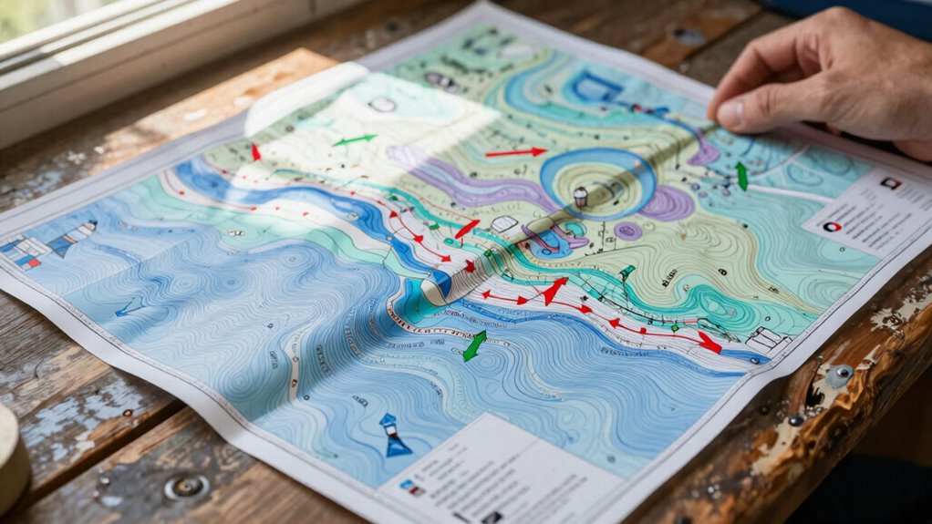
Decoding Nautical Symbols and Color Codes on Charts

You need to understand what the symbols on a nautical chart represent so you can navigate safely. Recognizing these symbols helps you identify hazards, navigation aids, and underwater features quickly. Additionally, interpreting the color codes reveals essential information about water depth, types of seabed, and navigable areas. Familiarity with chart symbols enhances your ability to interpret the chart accurately and avoid potential dangers while at sea. Gaining knowledge about digital navigation tools can further improve your understanding and safety when reading nautical charts. Incorporating advanced security features found in modern charts can also help protect navigational data from tampering or unauthorized access. Moreover, understanding ethical considerations related to digital data use can help ensure responsible navigation practices and data privacy. Recognizing the importance of color coding helps mariners quickly assess navigational conditions and hazards.
Recognizing Symbol Meanings
Nautical charts rely heavily on symbols and color codes to convey crucial information about underwater features, navigation hazards, and safe passages. To understand these symbols, you should familiarize yourself with maritime legends and chart legends, which explain what each symbol represents. Recognizing symbol meanings helps you identify submerged rocks, wrecks, buoys, and navigational aids quickly.
- Symbols indicating wrecks or obstructions
- Depth contours and soundings
- Buoy and beacon icons
- Underwater cables or pipelines
- Special markings for restricted or hazardous areas
Interpreting Color Significance
Colors on nautical charts aren’t just for decoration; they encode essential information about water depths, seabed types, and navigational safety. Light blue indicates shallow waters, warning you to stay clear of potential hazards, while darker shades show deeper areas. Red and green marks identify navigational aids like buoys and channel markers, helping you follow safe routes. These colors also highlight restricted zones or areas with maritime safety concerns, alerting you to avoid or proceed with caution. These color coding conventions are standardized internationally, making it easier for mariners from different regions to read charts accurately. Understanding these color significances enables you to interpret the chart more effectively, ensuring safer navigation and better decision-making on the water. Familiarity with maritime safety symbols further enhances your ability to navigate confidently and avoid dangers. Additionally, recognizing the significance of indigenous wellness practices can foster a deeper respect for traditional knowledge embedded in cultural artifacts.

Reelsonar Portable Fish Finder Accurate Fish Depth Finder with Depth Range of 135 feet 10+ Hours Battery Life with iOS & Android App Wireless
【𝐄𝐚𝐬𝐲 𝐭𝐨 𝐔𝐬𝐞 】 Reelsonar portable fish finder is Easy to use, With a depth range of 135...
As an affiliate, we earn on qualifying purchases.
How to Read Depths, Currents, and Navigational Aids During Your Voyage
Understanding depths, currents, and navigational aids is essential for a safe and efficient voyage. You’ll need to interpret tidal information to plan your arrival times and avoid shallow areas. Currents influence your boat’s speed and direction, so check current arrows and flow strength on the chart. Navigational aids like buoys and beacons mark safe passages and hazards. Use weather overlays to anticipate changing conditions that affect depths and currents. Pay attention to symbols indicating submerged rocks or wrecks, which can be hidden hazards. By mastering these elements, you’ll navigate confidently and avoid surprises. Keep these tips in mind:
- Review tidal charts and timings
- Observe current arrows and flow data
- Identify navigational aids and their meanings
- Use weather overlays for real-time updates
- Watch for submerged hazards on the chart

Venterior Portable Rechargeable Fish Finder Wireless Sonar Sensor Fishfinder Depth Locator with Fish Size, Temperature, Bottom Contour, Color Display
Castable: No more long & heavy cable for transducer. Clear Color Screen: it comes with clear color TFT...
As an affiliate, we earn on qualifying purchases.
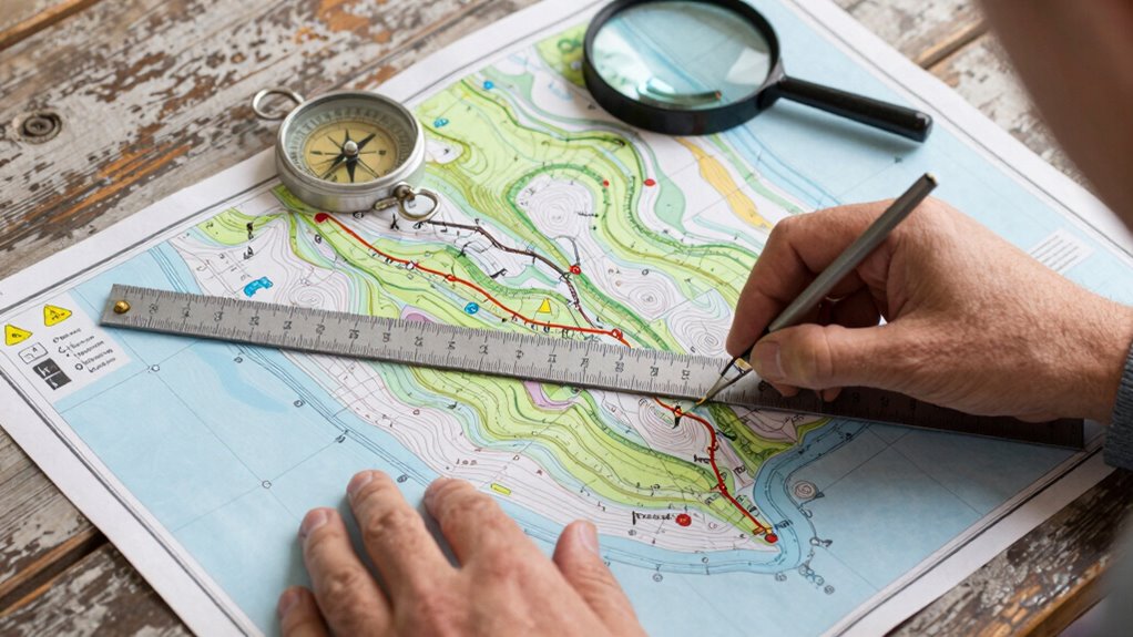
Planning Safe Routes and Spotting Hazards at a Glance
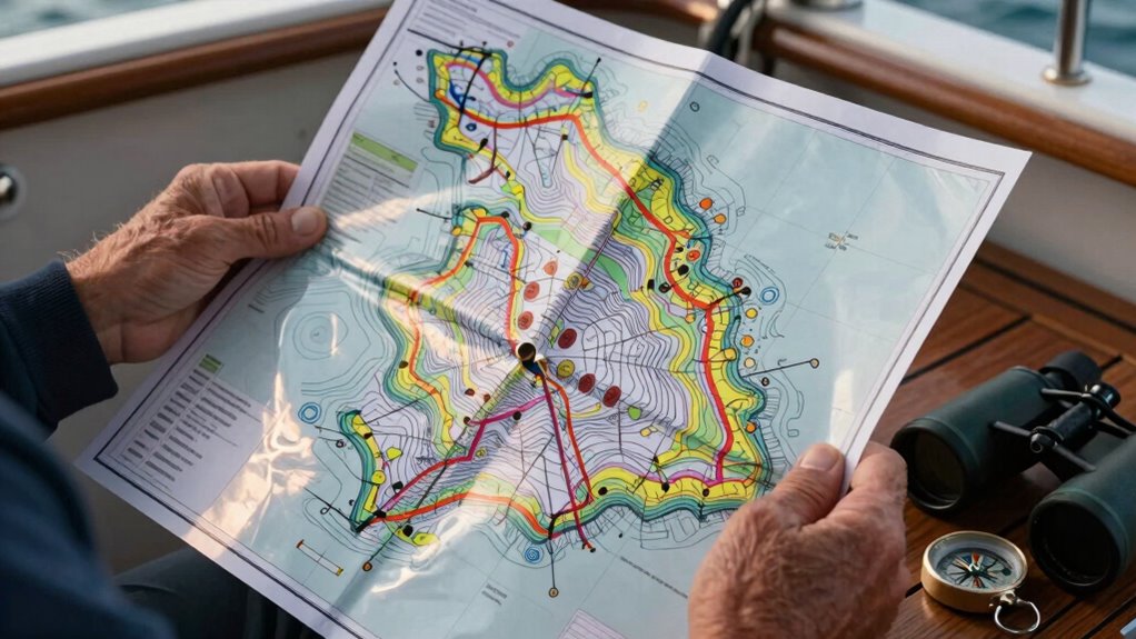
To plan safe routes and quickly spot hazards, you need to scan your nautical chart strategically before and during your voyage. Check weather conditions that could impact navigation, such as storms or fog, and identify areas prone to strong currents or low visibility. Use symbols and annotations to mark potential dangers like rocks, shoals, or wrecks. Maintain clear communication protocols with your crew, ensuring everyone understands the planned route and hazards. Look for safe anchorages and alternative paths in case conditions change unexpectedly. Constantly reassess your surroundings, updating your route as needed. Being vigilant and prepared helps you avoid surprises, keeping your voyage safe and efficient. Proper planning and hazard spotting are key to confident navigation at sea.
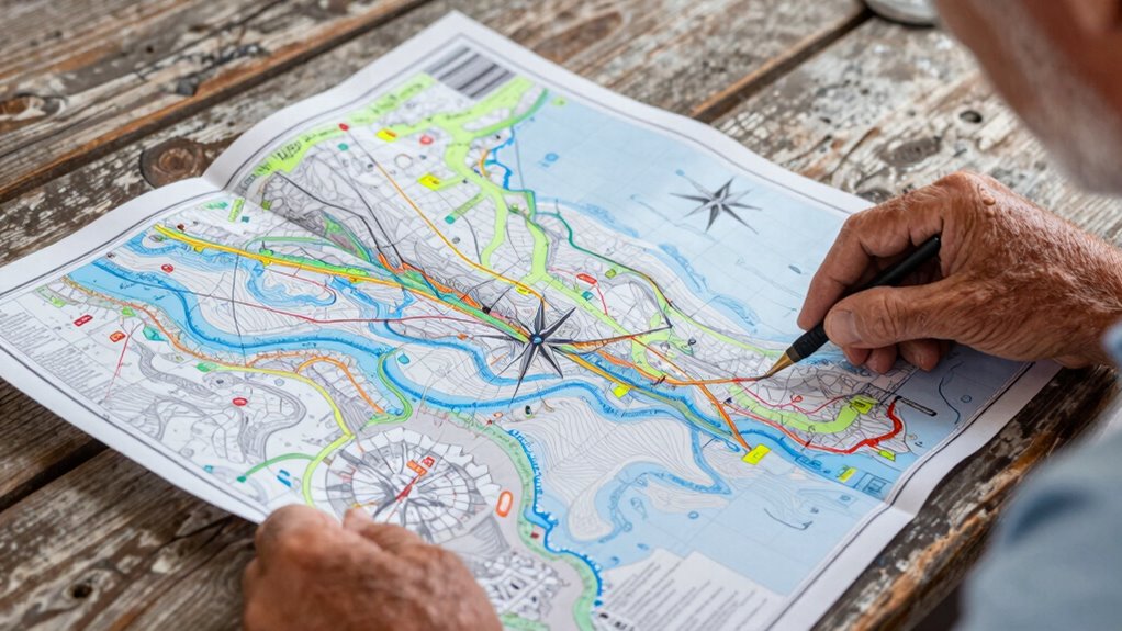
Using the Compass Rose and Coordinates for Accurate Navigation
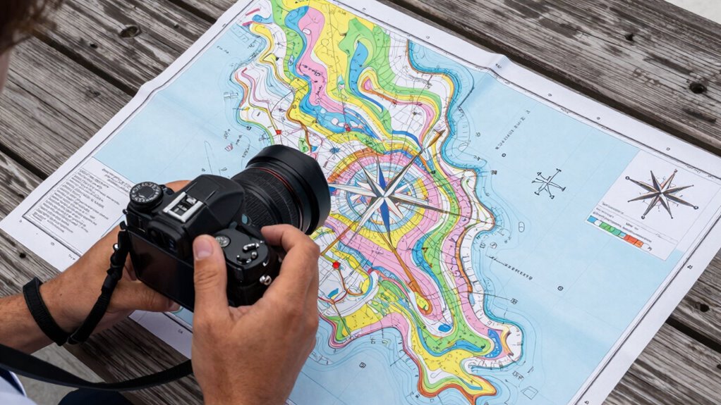
A key step in guaranteeing your vessel stays on course involves mastering the use of the compass rose and geographic coordinates. The compass rose shows true and magnetic north, but remember to account for magnetic declination, which varies by location and affects your readings. Proper chart orientation aligns the chart with the actual directions you’re traveling, making navigation more accurate. Using coordinates like latitude and longitude helps pinpoint your position precisely. To stay on course, regularly cross-reference your compass rose with your GPS data. Adjust for magnetic declination as needed to avoid errors. This ensures your navigation remains accurate, especially when plotting courses or identifying your position on the chart. Understanding Northeast – These Fifty States can also serve as a reminder to stay attentive and adapt to unexpected deviations during navigation. Additionally, familiarity with magnetic declination and its impact on compass readings is essential for precise navigation. Recognizing how magnetic variation influences compass readings is crucial for correcting your course and maintaining accuracy.
Practical Tips for Interpreting Nautical Charts When Planning Your Trip
When planning your trip, start by recognizing the nautical symbols that mark hazards and features. Next, understand depth contours to gauge safe passage routes and avoid shallow areas. Finally, identify navigational aids like buoys and lighthouses to help confirm your position and stay on course.
Recognize Nautical Symbols
Ever wonder how to quickly identify key features on a nautical chart? Recognizing nautical symbols is essential for safe navigation. Start by familiarizing yourself with maritime legends, which decode the symbols used across charts. These legends, often found in the chart legends section, explain what each symbol represents. Look for common symbols like buoys, lighthouses, wrecks, and anchorage areas. Remember, standardized symbols make navigation easier, but they vary slightly by region. Keep the maritime legends handy to avoid confusion. With practice, you’ll quickly interpret these symbols and better understand the chart’s information, making your trip planning smoother and safer. Additionally, paying attention to symbol consistency helps ensure accurate interpretation across different charts and regions.
Understand Depth Contours
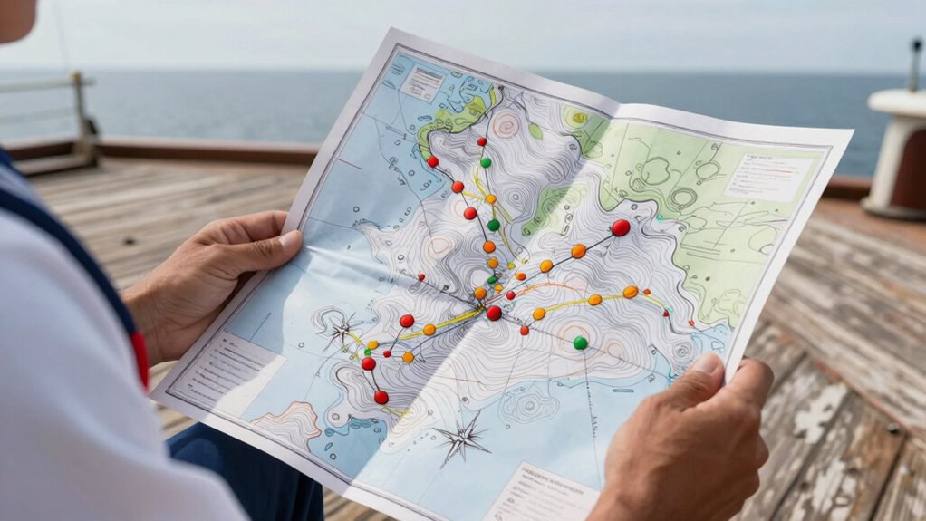
Understanding depth contours is crucial for safe navigation, especially when planning your route. These contours illustrate underwater topography, showing where the seabed rises or drops. Pay close attention to the spacing of the lines: tightly packed contours indicate steep changes, while wider spaces show gentle slopes. Tidal flow can considerably influence shallow areas, so consider how tides might expose or submerge features. Depth contours help you identify safe passages and avoid hazards like shallow reefs or submerged rocks. Use them to determine the depth at various points along your route and anticipate how underwater features could impact your vessel. Understanding depth contours is essential for accurate interpretation and safe navigation. Additionally, familiarizing yourself with navigation symbols on the chart can further enhance your route planning and safety.
Identify Navigational Aids
Navigational aids are essential tools that guide you safely through unfamiliar waters, so it’s important to identify them accurately on nautical charts. Recognizing buoys, beacons, lighthouses, and other aids helps you follow safe routes while adhering to maritime regulations. Pay attention to symbols and color codes that indicate their type and purpose. When planning your trip, consider weather pattern analysis to anticipate visibility and sea conditions affecting navigational aids. Familiarity with essential safety tips for portable oil radiators can also be useful for ensuring safety on deck in various weather conditions.
- Look for buoy shapes and colors that mark channels or hazards
- Identify lighthouse symbols for coastal navigation
- Note the differences between lateral and cardinal marks
- Check for regulatory markers indicating restricted areas
- Cross-reference aids with weather forecasts for safe passage
- Understanding navigational aid symbols enhances your ability to interpret nautical charts effectively
Common Mistakes to Watch Out for When Reading Charts
One common mistake when reading nautical charts is misinterpreting symbols or scales, which can lead to incorrect assumptions about water depths or hazards. Incorrect symbol interpretation can cause you to overlook dangerous areas or navigate incorrectly. Additionally, neglecting tide information is a frequent error; tides considerably affect water depths and navigation conditions. Failing to account for tide changes may lead to grounding or hitting submerged hazards. Always double-check symbols for clarity and consult tide tables before your trip. Rushing through the chart without verifying these details increases risks. Staying attentive to symbols and tide data helps you avoid costly mistakes and navigates safely. Remember, careful interpretation of charts is crucial for safe and confident sailing. Paying close attention to chart symbols and scales ensures accurate understanding of the navigational information. Moreover, understanding tide data and how it influences water depths can significantly improve your navigation decisions and safety. Recognizing how local maritime conditions impact water levels and hazards can provide an extra layer of safety during your voyage. Properly assessing marine weather patterns can also help you prepare for sudden changes that might affect navigation.
Frequently Asked Questions
How Often Are Nautical Charts Updated and Where Can I Find the Latest Versions?
Nautical charts are typically updated every 6 to 12 months to guarantee chart accuracy and support maritime safety. You can find the latest versions through official sources like the NOAA for U.S. waters or your country’s maritime authority. Always use the most recent charts to avoid hazards and navigational errors. Regular updates help you stay informed about changes, ensuring safer navigation and better adherence to maritime safety standards.
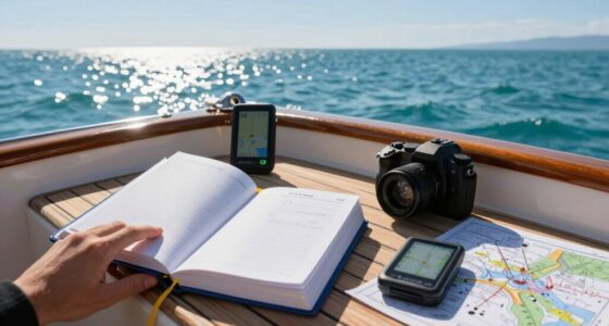
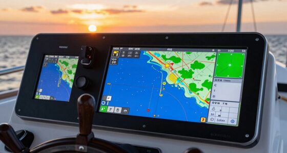
What Tools or Apps Can Assist Me in Reading Nautical Charts More Easily?
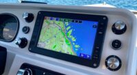
Reading nautical charts is like having a reliable compass. You can use digital navigation tools and apps, such as Navionics or C-MAP, to make chart plotting easier. These tools provide real-time updates, detailed overlays, and user-friendly interfaces that help you understand complex symbols and depths. With these apps, you’ll navigate confidently, even in unfamiliar waters, turning chart reading from a challenging task into a smooth sailing experience.
How Do I Interpret Tide and Weather Information on Nautical Charts?
You interpret tide and weather info on nautical charts by checking tide prediction symbols and annotations, which show high and low tides, helping you plan your approach. Look for weather overlays, like wind arrows and forecast symbols, to understand current and upcoming conditions. These details guide your navigation, ensuring safe passage. Always cross-reference tide predictions and weather overlays for the most accurate, real-time information before setting out.
Can I Use a Nautical Chart for Inland Waterways or Only for Open Sea Navigation?
You can definitely use a nautical chart for inland waterways, as they often include detailed chart symbols and adhere to maritime regulations for safe navigation. Just make certain you select the correct chart type for inland or coastal areas. These charts help you understand depths, buoys, and other markers specific to inland navigation, making it easier to stay compliant and avoid hazards while following maritime rules.
What Training or Courses Are Recommended for Mastering Nautical Chart Reading Skills?
Think of mastering maritime navigation like learning to ride a bike—you need balance and practice. To excel at chart reading fundamentals, consider courses from organizations like the US Coast Guard or local maritime schools. These programs teach essential skills, including navigation rules and chart symbols. Attending such training will boost your confidence, helping you navigate safely whether on inland waterways or open seas, just like learning to ride with confidence.
Conclusion
Mastering nautical charts is vital for safe sailing, and with practice, you’ll navigate with confidence. Did you know that nearly 90% of maritime accidents are caused by human error, often linked to misreading charts? By understanding symbols, depths, and routes, you reduce risks and enhance your voyage. Keep honing your skills, stay alert, and enjoy the journey—your safe passage depends on it. Happy sailing!