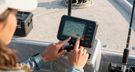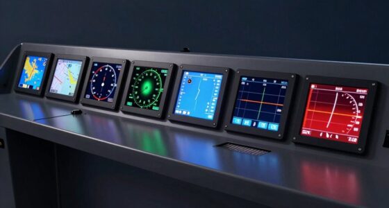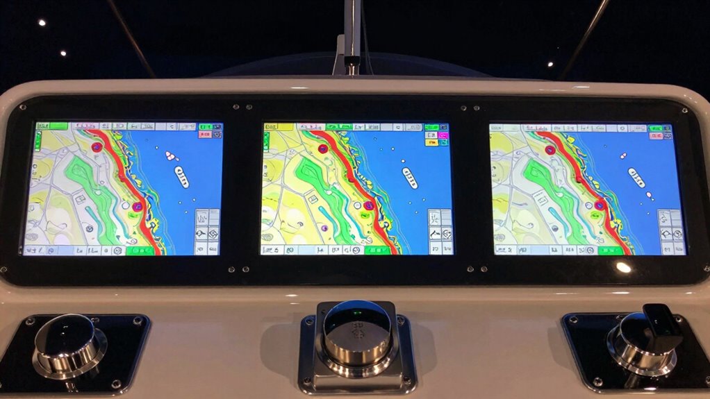
Choosing a marine chartplotter with AIS integration requires balancing display size, sonar capabilities, ease of use, and connectivity. For 2026, I’ve identified five standout options, each excelling in different areas. The Garmin GPSMAP 1243xsv leads with a large, high-res touchscreen and advanced sonar, making it ideal for serious anglers and navigators. The Garmin ECHOMAP UHD2 94sv is better suited for those seeking user-friendly coastal navigation with wireless sharing features. Meanwhile, the GPSMAP 1222xsv offers a straightforward, large display for combined navigation and fishing. The Simrad GO series provides a versatile, multifunction approach with radar options for larger vessels, and the Garmin GPSMAP 943xsv balances high-quality sonar with compact size. Each choice involves specific tradeoffs around complexity, price, and feature set, making your decision hinge on your boat type and intended use.

Get sports gear delivered free — and shop member deals
- Fast, free delivery on millions of items
- Access to Prime Big Deal Days deals on October 6–7
- Prime Video, Amazon Music and more included
Complete the kit


Key Takeaways
- The Garmin GPSMAP 1243xsv offers a large, detailed display with advanced sonar, ideal for serious anglers and navigators willing to invest in top-tier features.
- The Garmin ECHOMAP UHD2 94sv prioritizes ease of use, coastal charting, and wireless sharing, making it perfect for boaters who want simplicity and connectivity.
- The GPSMAP 1222xsv provides a large touchscreen with integrated sonar in a more straightforward package, suitable for those seeking all-in-one navigation and fishing tools.
- Simrad GO models incorporate radar and multifunction capabilities, fitting larger vessels or those needing comprehensive systems with more complex setup requirements.
- The Garmin GPSMAP 943xsv brings high-definition imaging into a compact size, excellent for boaters balancing sonar detail and straightforward operation.
| Garmin GPSMAP 1243xsv 12-Inch Chartplotter Fishfinder with Navionics Plus |  | Best Overall for Serious Anglers and Navigators | Display: 12.1-inch touchscreen | Sonar: ClearVü, SideVü, Traditional Chirp, Panoptix support | Preloaded Maps: Navionics Plus | VIEW ON AMAZON | See Our Full Breakdown |
| Garmin ECHOMAP UHD2 94sv with GT56 Transducer, 9-Inch Touchscreen Chartplotter with Navionics+ U.S. Coastal Charts |  | Best for Ease of Use and Coastal Navigation | Display: 9-inch touchscreen | Transducer: GT56-TM | Charts: Navionics+ U.S. Coastal | VIEW ON AMAZON | See Our Full Breakdown |
| GPSMAP 1222xsv 12″ MFD with Sonar and Basemap |  | Best for Simplicity and Large Display | Display Size: 12 inches | Features: MFD, Sonar, Basemap | VIEW ON AMAZON | See Our Full Breakdown | |
| Simrad GO Chartplotter and Fish Finder with Transducer and Radar Options |  | Best for Multifunctional and Larger Vessels | Display: Multifunction | Chart Card: C-MAP DISCOVER | Sonar: Active Imaging 3-in-1 | VIEW ON AMAZON | See Our Full Breakdown |
| Garmin GPSMAP 943xsv 9″ Chartplotter Fishfinder with SideVü and ClearVü Chirp, Touchscreen, Built-in Navionics Plus |  | Best Compact with High-Definition Sonar | Display: 9-inch touchscreen | Sonar Support: SideVü, ClearVü, traditional Chirp | Maps: Navionics Plus | VIEW ON AMAZON | See Our Full Breakdown |
| marine chartplotter with ais integration | Display |
|---|---|
| Garmin GPSMAP 1243xsv 12-Inch | 12.1-inch touchscreen |
| Garmin ECHOMAP UHD2 94sv with | 9-inch touchscreen |
| GPSMAP 1222xsv 12" MFD with So | — |
| Simrad GO Chartplotter and Fis | Multifunction |
| Garmin GPSMAP 943xsv 9" Chartp | 9-inch touchscreen |
More Details on Our Top Picks
Garmin GPSMAP 1243xsv 12-Inch Chartplotter Fishfinder with Navionics Plus
The Garmin GPSMAP 1243xsv stands out for its massive 12-inch high-definition touchscreen, offering clear visibility in bright conditions. Its support for multiple sonar technologies, including Panoptix, provides detailed underwater imaging — a critical feature for anglers who need precise fish targets and structure detection. Preloaded with Navionics Plus charts, it supplies detailed mapping for both coastal and inland waters. However, the extensive features come with a high price tag and a setup process that may intimidate newcomers. Compared with smaller or simpler units, this model emphasizes advanced capabilities at the expense of a steeper learning curve.
Pros:- Large, high-resolution 12-inch touchscreen display
- Supports multiple sonar technologies including Panoptix
- Preloaded Navionics Plus charts for detailed mapping
- Waterproof IPX7 rating for durability
Cons:- High cost may be prohibitive for some users
- Complex setup requiring technical familiarity
Best for: Serious anglers and experienced boaters seeking comprehensive navigation and fishing features.
Not ideal for: Casual boaters or those new to marine electronics who prefer straightforward operation and simpler interfaces.
- Display:12.1-inch touchscreen
- Sonar:ClearVü, SideVü, Traditional Chirp, Panoptix support
- Preloaded Maps:Navionics Plus
Our verdict“This model excels for those who prioritize detailed imaging and advanced features but requires a willingness to navigate its complexity.”
Garmin ECHOMAP UHD2 94sv with GT56 Transducer, 9-Inch Touchscreen Chartplotter with Navionics+ U.S. Coastal Charts
The Garmin ECHOMAP UHD2 94sv offers a bright, 9-inch touchscreen optimized for sunlight readability, making it a practical choice for coastal boaters. Its included GT56 transducer supports traditional sonar, ClearVü, and SideVü scanning, providing versatile underwater views. The device’s wireless connectivity allows for easy data sharing and control via compatible Garmin accessories, simplifying setup and operation. Nevertheless, full wireless features depend on pairing with other Garmin devices, which may limit flexibility for some users. Its slightly smaller display compared to larger units means less detailed onboard mapping, but it strikes a good balance between performance and user-friendliness.
Pros:- Bright, sunlight-readable 9-inch touchscreen
- Includes detailed U.S. Coastal Navionics+ charts
- Supports multiple sonar options with GT56 transducer
- Wireless sharing and device control features
Cons:- Limited to Garmin-compatible wireless features
- Potentially higher cost for premium features
Best for: Coastal boaters and anglers who prioritize straightforward operation and wireless connectivity.
Not ideal for: Vessels requiring the largest screens or advanced multi-system integration without compatible Garmin devices.
- Display:9-inch touchscreen
- Transducer:GT56-TM
- Charts:Navionics+ U.S. Coastal
Our verdict“Ideal for boaters wanting an intuitive, coastal-focused chartplotter with useful wireless capabilities, though it may require additional Garmin hardware for full functionality.”
GPSMAP 1222xsv 12″ MFD with Sonar and Basemap
The GPSMAP 1222xsv delivers a straightforward 12-inch display with integrated sonar and preloaded Basemap, making it a reliable choice for boaters who want a large, easy-to-read screen without excessive complexity. Its all-in-one design simplifies installation and operation, providing essential navigation and fishing features in a single device. However, it offers fewer advanced options compared to high-end models, and detailed specifications are limited, which may leave power users wanting more. Compared with the Garmin units, it emphasizes ease over extensive customization or specialized imaging.
Pros:- Large, easy-to-read 12-inch display
- Integrated sonar with detailed mapping
- Preloaded Basemap for straightforward navigation
Cons:- Limited advanced features and customization
- No detailed specifications or customer ratings available
Best for: Boaters seeking a large, simple system for navigation and fishing without advanced sonar or connectivity features.
Not ideal for: Advanced anglers or tech-savvy users who need detailed imaging, wireless sharing, or multiple system integrations.
- Display Size:12 inches
- Features:MFD, Sonar, Basemap
Our verdict“A solid choice for boaters prioritizing size and simplicity, with enough features for general navigation and fishing.”
Simrad GO Chartplotter and Fish Finder with Transducer and Radar Options
The Simrad GO series combines GPS, sonar, and radar into a single multifunction display, making it ideal for larger boats or those needing a comprehensive system. The included C-MAP Discover chart card offers detailed charts, and the Active Imaging 3-in-1 sonar provides high-resolution imaging. Its compatibility with radar hardware and NMEA 2000 systems means it supports complex setups for larger vessels. However, deploying radar and additional hardware increases cost and complexity, and the initial setup can be challenging for less experienced users. It’s best suited for boaters who demand an all-in-one, expandable solution.
Pros:- Supports GPS, sonar, and radar in a single display
- Includes detailed C-MAP Discover charts
- Supports Active Imaging 3-in-1 sonar
Cons:- Requires additional radar hardware for full radar functionality
- Setup can be complex for beginners
Best for: Larger vessels or advanced boaters who want integrated radar, detailed charts, and multisystem control.
Not ideal for: Small boats or casual users who prefer plug-and-play simplicity without additional hardware investments.
- Display:Multifunction
- Chart Card:C-MAP DISCOVER
- Sonar:Active Imaging 3-in-1
Our verdict“Designed for experienced boaters with larger vessels, this system offers versatility but demands more investment and technical setup.”
The Garmin GPSMAP 943xsv combines a 9-inch touchscreen with high-definition sonar imaging, including SideVü and ClearVü, for detailed underwater views. Its support for Panoptix adds versatile scanning options, making it suitable for anglers who want high-quality imaging in a more manageable size. Preloaded Navionics Plus maps aid navigation, and the touchscreen interface simplifies operation. However, its smaller size may limit visibility for some users, and the high-end sonar features can drive up the price. Compared to larger units, it’s a better fit for boaters who prioritize portability without sacrificing imaging quality.
Pros:- High-definition SideVü and ClearVü sonar
- Supports Panoptix sonar for versatile scanning
- Preloaded Navionics Plus maps
- Touchscreen for easy operation
Cons:- High price for a smaller device
- Learning curve for advanced sonar features
Best for: Anglers and boaters who need a compact, high-performance sonar device with detailed underwater imaging.
Not ideal for: Those requiring large screens or full multifunction systems with radar integration.
- Display:9-inch touchscreen
- Sonar Support:SideVü, ClearVü, traditional Chirp
- Maps:Navionics Plus
Our verdict“This pick is perfect for anglers wanting high-quality imaging in a compact size, though it may be costly and complex for beginners.”

How We Picked
Our selection process focused on core features that matter most in AIS-integrated marine chartplotters: display size and clarity, sonar versatility, ease of use, connectivity options, and overall build quality. We prioritized products with proven AIS capabilities, detailed mapping, and reliable navigation features. Tradeoffs such as complexity, price, and additional hardware requirements were considered to ensure each product serves a specific type of boater—from anglers to coastal cruisers and larger vessel operators.
Factors to Consider When Choosing Marine Chartplotter With Ais Integration
When selecting a marine chartplotter with AIS, it’s vital to consider how display size and clarity impact your ability to interpret navigation and sonar data quickly. Sonar capabilities vary from basic traditional models to advanced imaging like SideVü and Panoptix, which can significantly improve underwater visibility. Connectivity options, including wireless sharing and compatibility with other devices, enhance usability but may add to the complexity and cost. Larger vessels or serious anglers typically benefit from bigger, more feature-rich systems, whereas casual boaters or those focused on coastal navigation might prefer simpler, more affordable options. Balancing these factors based on your boat size, budget, and skill level will help pinpoint the best fit.Display Size and Resolution
The size and resolution of the display directly influence how easily you can read charts and sonar images at a glance. Larger screens like 12 inches offer more real estate for detailed maps and sonar data, reducing eye strain and allowing quicker interpretation. However, bigger units tend to be more expensive and may require more space on your vessel. Smaller screens, around 9 inches, still provide good clarity but may feel cramped when viewing complex sonar imagery. Prioritize a high-resolution display if detailed imaging is essential for your fishing or navigation needs.
Sonar Capabilities
Sonar technology varies from basic traditional Chirp to advanced imaging like SideVü, ClearVü, and Panoptix support. Standard sonar is sufficient for general fish detection, but if you want detailed underwater images, models supporting SideVü and Panoptix deliver a clearer picture of fish and structure. These features are especially valuable for serious anglers, though they come at a higher cost and may require additional hardware. Consider your fishing style and whether advanced imaging will significantly improve your experience.
Connectivity and Ease of Use
Wireless features such as Wi-Fi enable easy data sharing, software updates, and device control, simplifying operation on the water. Compatibility with other Garmin or Simrad devices can expand your system’s capabilities but may require additional investment. Ease of use is equally important—touchscreens with intuitive interfaces reduce learning curves, especially for beginners. Weigh the benefits of wireless and integrated connectivity against potential setup complexity and added expenses.
Mapping and Chart Options
Preloaded charts like Navionics Plus provide detailed coastal and inland navigation, essential for safe boating. Some units offer the ability to load or update maps wirelessly, which is convenient. The choice of charts can influence your safety and navigational confidence, so ensure the device supports the regions where you boat most often. For anglers, detailed bathymetric charts can help locate fish-holding structures and improve catch rates.
Additional Hardware and System Complexity
Advanced systems, especially those combining radar, multiple sonar types, and network connectivity, often require additional hardware like radar antennas or extra transducers. While these features enhance situational awareness and fishing success, they increase setup complexity and costs. Beginners or those with smaller vessels might prefer streamlined systems with fewer extras, while larger or more technically equipped boats can benefit from full integration.
Frequently Asked Questions
What is AIS, and why should I consider it in a marine chartplotter?
Automatic Identification System (AIS) is a technology that broadcasts a vessel’s position, course, and speed to nearby ships, enhancing safety by preventing collisions. When integrated into a chartplotter, AIS provides real-time traffic information directly on your display, allowing you to see potential hazards and navigate more confidently. AIS integration is especially valuable in busy waterways, high-traffic areas, or for vessels operating at night or in poor visibility conditions.
How important is sonar capability in a chartplotter with AIS?
Sonar capability significantly enhances a chartplotter’s utility for fishing and underwater exploration. Advanced sonar features like SideVü, ClearVü, and Panoptix provide detailed images of what’s beneath and around your vessel, helping locate fish and underwater structures with greater precision. For navigation alone, basic sonar might suffice, but for anglers and those seeking detailed underwater imaging, higher-end sonar support is a key consideration. Balancing sonar features with your budget and boating style ensures you get the right system for your needs.
Is a larger display always better for a marine chartplotter?
While larger displays improve visibility and mapping detail, they also come with higher costs, increased size, and potential mounting challenges. For boaters who spend a lot of time on the water, a large, high-resolution screen can be a game-changer, reducing eye strain and allowing quicker data interpretation. Conversely, smaller units are more portable, easier to install, and often more affordable, making them suitable for smaller boats or casual use. Your choice should balance your space constraints, budget, and how much screen real estate you need for safe and effective navigation.
What connectivity options should I look for in a marine chartplotter?
Wireless connectivity features like Wi-Fi or Bluetooth enable quick updates, data sharing, and device control, streamlining on-water operation. Some models support wireless integration with smartphones, tablets, or other Garmin/Simrad systems, providing additional control and data access. However, these features often require compatible devices and can add complexity or cost. Consider your comfort with technology and whether you need seamless data sharing or remote control capabilities in your boating routine.
Are all AIS-enabled chartplotters suitable for all boat types?
No, not all AIS-capable chartplotters are equally suited for every vessel. Larger boats and commercial vessels benefit from integrated AIS with radar and multiple system support, enhancing safety and situational awareness. Smaller recreational boats can find AIS integration helpful but may not need the full suite of features, often preferring simpler or more compact units. Assess your vessel’s size, typical routes, and safety requirements to select a system that balances capabilities with complexity and budget.
Conclusion
For boaters prioritizing navigation and fishing on larger vessels or seeking comprehensive systems, the Simrad GO models offer advanced features and expandability. Casual coastal boaters and anglers who want a straightforward, easy-to-use device should consider the Garmin ECHOMAP UHD2 94sv. Those seeking a balance of high-resolution sonar in a manageable size will find the Garmin GPSMAP 943xsv appealing, especially if space is limited. Finally, anglers and boaters needing maximum detail and a large display might lean towards the Garmin GPSMAP 1243xsv, despite its higher complexity and price. Each option aligns with different priorities, ensuring you find a system tailored to your boating style and safety needs.
Fall Picks
fall essentials
As an affiliate, we earn on qualifying purchases.