TL;DR

Get sports gear delivered free with Prime
- Fast, free delivery on millions of items
- Prime Video, Amazon Music and more included
- Member-only deals all year
Marine GPS navigation systems use satellite signals to estimate a vessel’s position, speed, and direction; chartplotters display that position on electronic charts and may combine it with radar, sonar, and AIS. GPS helps you navigate, but it does not replace current chart data, awareness of weather and hazards, or a backup plan. Check your equipment before departure and know how you will navigate if its position becomes unreliable.
A bright blue dot can make a complicated stretch of coast feel simple. But marine GPS navigation systems show you an estimated position; they do not tell you whether a shoal has shifted, a current has pushed you sideways, or another boat is crossing your path.
This guide explains how GPS and chartplotters work together, what can affect them, and how to choose a setup that fits your boat. You’ll also learn a few straightforward checks that help you use electronic navigation without treating one screen as your whole plan.
A GPS receiver provides position data; a chartplotter places that position on electronic charts, and a multifunction display may combine it with other equipmen…
Check chart coverage, scale, and update information; zooming in does not add detail to the chart.
Confirm datum compatibility, antenna placement, power, and connections before relying on a system underway.
Keep a charged backup and know an independent navigation method suitable for your vessel and voyage.
Cross-check implausible positions against other available references and your observations.
What marine GPS tells you—and what it leaves out
Marine GPS navigation systems use satellite signals to estimate a vessel’s position, speed, and direction. That position is a measurement at a particular moment, not a complete description of the vessel’s situation. It can tell you where the receiver calculates you are, but not whether the chart beneath that position is current, whether a hazard has moved, or how wind and current are affecting your track.
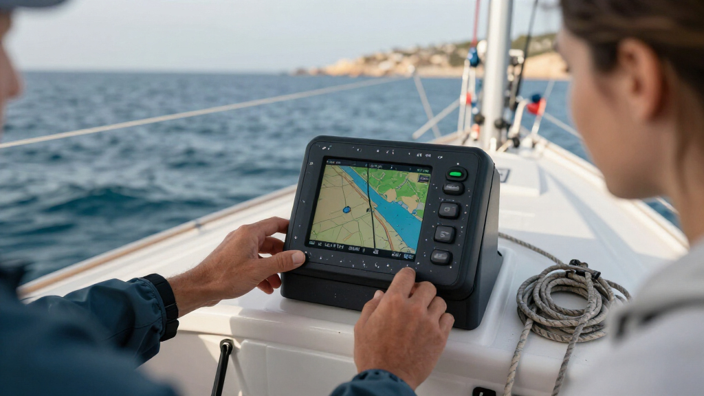
GPS is one part of a broader navigation picture. A chartplotter places the fix over electronic chart data, while a multifunction display may also show radar, depth from sonar, AIS targets, and instrument readings. Each layer answers a different question: the chart depicts mapped features, radar detects returns around you, sonar measures water beneath the boat, and AIS reports information transmitted by equipped vessels. Comparing them can reveal inconsistencies, but none sees everything. For example, not every vessel carries AIS, and a chart cannot show a newly formed obstruction unless its data has been updated.
Imagine motoring toward a harbor on a foggy morning. Your display may show your position and a charted channel, while radar helps reveal nearby vessels and depth readings show the water beneath your boat. If the depth changes unexpectedly or radar shows traffic near your intended track, that is a reason to reassess the route rather than assume the blue dot makes it safe. The value of the display comes from interpreting independent clues together, while continuing to watch, listen, and apply local navigation rules.
Your position is one clue. Safe navigation comes from checking it against charts, conditions, and what you can observe around you.
See what a chartplotter adds to a GPS receiver
Marine GPS navigation systems range from a basic receiver that reports coordinates to a chartplotter that overlays your estimated position on electronic chart data. Some units combine both functions. A receiver can be enough when your task is simply to know or record a position; a chartplotter adds spatial context that can help you relate that position to channels, coastlines, and mapped hazards. That context is only as useful as the chart coverage and data behind it.
| Equipment | What it provides | What to check |
|---|---|---|
| GPS receiver | Position, speed, and direction from satellite signals | How clearly it reports position quality and alarms |
| Chartplotter | Position displayed against electronic chart data | Coverage, chart scale, update dates, and readability |
| Multifunction display | Charts plus connected data such as radar, sonar, AIS, or instruments | Compatibility, network setup, and shared power needs |
Suppose you take a small open boat on familiar lakes and mainly need coordinates. A simple receiver may be easier to install and use, with fewer connections and power demands. If you run coastal routes near marked channels, a chartplotter can make it easier to compare your fix with mapped features. The added screen and chart subscription may cost more, and connected equipment introduces installation and compatibility needs, so consider whether those features answer real questions on your trips.
A chart’s scale matters because it affects how much surveyed detail is represented in a given area. Zooming in enlarges the image; it cannot reveal details that were never included in the source data, and it may create a misleading sense of precision. Check that the chart covers your route at a useful scale and that its update date and source are appropriate for the voyage. When a route passes close to hazards, chart display alone is not a reason to cut margins or skip other checks.
Understand which satellites and corrections your receiver uses
Marine GPS navigation systems calculate position from satellite signals, while the broader term GNSS covers satellite navigation systems such as GPS, Galileo, GLONASS, and BeiDou. A receiver that can use several constellations may have more signals available, which can help it maintain a position in some difficult settings. More signals do not guarantee a correct fix: reception can still be blocked, reflected, or disrupted, and the receiver must judge which signals to use.
A clear view of the sky can help the antenna receive signals. A metal roof or nearby structure can block or reflect them; poor wiring or an unreliable power supply can cause failures that look like a navigation problem. Antenna placement therefore affects more than convenience: a weak or unstable fix can make the displayed position less dependable precisely when visibility or proximity to hazards makes cross-checking important. Follow the manufacturer’s installation guidance, and verify connected devices communicate as intended.
Some receivers also use satellite-based augmentation systems, such as WAAS, EGNOS, or MSAS, where coverage and equipment support them. These services can provide corrections and integrity information, improving the receiver’s estimate or helping it identify certain problems. Availability and performance depend on location, receiver capability, and signal reception, so an augmentation feature listed in specifications is not a promise of uniform benefit on every voyage. Check the documentation for your area and learn how the unit reports whether the service is in use.
For example, a receiver tucked under a hardtop may behave differently from one with an antenna mounted where it has a clearer sky view. If position quality looks poor or changes unexpectedly, check the status display and installation before trusting the reading. A stable signal indicator is useful information, but it cannot establish that chart data is current or that your calculated position agrees with conditions around the boat.
Use these checks before you leave the dock
Marine GPS navigation systems are more useful when you check their charts, settings, and backup before departure. These checks test different parts of the navigation chain: a working receiver is of little help if the chart omits your destination, and a good chart cannot help if the display loses power. A few minutes at the dock can reveal a missing chart, a flat battery, or a route that never transferred to the display.
- Check your chart coverage. Confirm that charts cover the whole route and use a suitable scale. Review update guidance from your chart provider. Coverage gaps or overly small-scale data can hide details, so verify the route rather than assuming a zoomed view contains more information.
- Check position and reference settings. Make sure chart and display datum settings are compatible; mismatched references can make positions appear offset. If two sources disagree, understanding their reference settings helps distinguish a display configuration issue from a genuine position problem.
- Check the installation. Confirm the unit powers on, the antenna has a clear view of the sky, and connected equipment shows expected data. A quick check of status and connections can catch a weak signal or failed network link before you depend on information that is not actually reaching the display.
- Check your route against conditions. Compare charted hazards with current weather, tides, currents, and local guidance. Charts describe mapped features, while changing conditions affect what is safe now; considering both can expose a route that looks clear on screen but is unsuitable in practice.
- Pack an independent backup. Carry a charged backup device and know the paper-chart or other navigation method appropriate to the trip. Independence matters: a second screen that relies on the same power source or data connection may fail for the same reason as the primary unit.
- Learn the controls. Set a waypoint, read the position display, and find the alarm settings before you need them underway. Familiarity reduces the chance that troubleshooting or a route change will distract you when conditions require attention outside the boat.
Consider a family day trip with a planned stop across a broad bay. Before casting off, you might check that the chart covers both the crossing and the destination, save the route, and confirm that a charged phone has offline charts available. The phone adds a separate way to view position if the main display fails, but its small screen, battery limits, and exposure to water mean it is best treated as one layer of a backup plan rather than the plan itself.
Spot trouble when the position stops making sense
Marine GPS navigation systems can lose or degrade their signal, and interference or spoofing can make position information unreliable. A sudden position jump, unexpected alarm, or disagreement with what you see on the water matters because electronic route guidance is only useful if its position input is trustworthy. Continuing to follow a suspect fix can compound the error as the boat moves.
Start by checking the receiver’s status and comparing its output with other references on board. Depending on your vessel and conditions, those references may include radar, depth, visual bearings, compass, or a properly prepared chart. These checks are useful because they rely on different observations and can help identify whether the problem is confined to one device or affects your navigation picture more broadly. Follow the applicable navigation procedures and switch to a suitable independent method when needed.
Satellite positioning generally works without cellular service, but downloading charts, getting certain updates, or using connected services may require internet access. Check that your app or equipment stores the charts you need before leaving coverage. A phone can be a handy backup on a calm afternoon, but a low battery and a wet touchscreen can quickly change the picture; equipment that depends on a different power source and a method you know how to use reduce the chance that one failure leaves you without a usable reference.
When a fix looks wrong, treat it as a signal to cross-check. Don’t let a reassuring symbol on the screen overrule other evidence.
Choose a system that fits the trips you actually make
The best marine GPS navigation systems for your boat are the ones you can read, power, maintain, and use on your planned voyages. Screen size alone won’t tell you whether a unit suits your cockpit or chart needs: installation space, glare, operating controls, and the data you need to interpret all affect whether a display helps underway.
If you mostly make short trips on familiar inland water, you may value a simple display and clear waypoints. A coastal skipper may put more weight on chart coverage, sunlight readability, networking, and links to radar or AIS. Integration can make information easier to compare because it brings several sources together, but it also adds cost, setup, and possible shared points of failure. Choose connections that support how you navigate, and understand which functions stop working if a network link or common power supply fails.
- Chart coverage and update costs: Confirm the regions you need and how the provider handles updates. This affects both the initial purchase and the continuing cost of keeping chart information useful.
- Display and installation: Check sunlight visibility, waterproofing, mounting space, and power use. A large screen is less helpful if glare makes it unreadable or its power demand strains the boat’s setup.
- Connections: Verify compatibility with your antenna, sensors, and onboard network. Compatibility determines whether connected data appears as expected and how much installation work is involved.
- Route tools and support: Try waypoint entry and route transfer, and check what help is available for your model. Difficult controls can add distraction when routes change or an alarm needs attention.
- Backup options: Decide what you will use if the display loses power or position data. A backup works best when it remains usable during the failure you are planning for and you have practiced with it.
Before buying, picture a real trip: gloved hands in a damp cockpit, a low winter sun on the screen, and a route change near a crowded entrance. That scenario will tell you more than a long feature list because it tests visibility, controls, and information you can interpret under pressure. Capabilities and product details change, so check current manufacturer documentation and local charting and safety guidance.
Frequently Asked Questions
Is marine GPS accurate enough for navigation?
A properly working receiver can support routine navigation, but actual performance depends on equipment, signal conditions, corrections, and surroundings. Check the position against suitable chart data and other available references, especially near hazards.
Can I use my phone as a marine GPS?
Often, a phone can provide satellite positioning and serve as a planning tool or backup. Check that you have offline charts and a suitable positioning setup, and protect the device from water, heat, and battery loss. It should not be your only navigation plan.
Does marine GPS work without cell service?
Satellite positioning generally does not require cellular service. Downloading charts, receiving some updates, and using connected services may require internet access, so check offline availability before departure.
What should I do if my GPS loses signal or shows a strange position?
Check alarms and position quality, then compare the display with other instruments or observations available on board. Treat sudden jumps or disagreement as a reason to use a suitable backup navigation method and follow local procedures.
Do I still need paper charts?
Requirements vary with the vessel, location, and voyage. Even where electronic navigation is permitted, keep an independent backup appropriate to your trip and learn how to use it.
Conclusion
Use marine GPS as a strong navigation aid, then check its position against suitable charts, conditions, and other clues around you. Before departure, confirm your setup and know which independent method you’ll use if the screen goes dark.
A good system should help you read the water—not make you stop looking at it.
NFL season / tailgating Picks
team gear
As an affiliate, we earn on qualifying purchases.