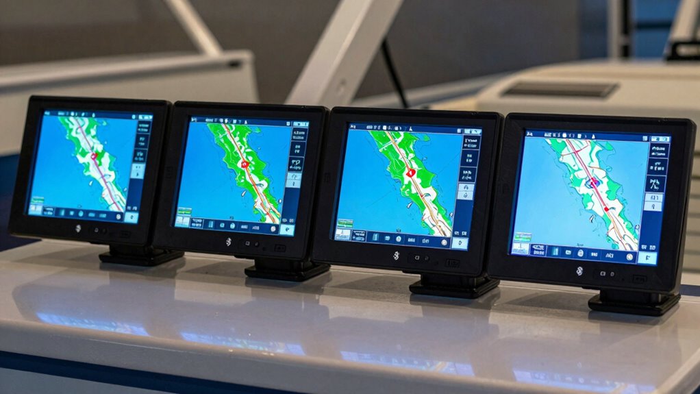

Choosing a marine chartplotter with Bluetooth can significantly enhance your navigation and fishing experience. For 2026, I’ve identified five standout options that balance connectivity, display quality, and features. The Garmin Echomap UHD2 54cv offers a compact, easy-to-use display with detailed sonar and Navionics maps, perfect for anglers who need simplicity. The Simrad GO9 stands out for its multifunction capabilities, combining GPS, sonar, and radar—ideal for serious boaters. Meanwhile, Garmin’s ECHOMAP UHD2 53CV provides a solid inland mapping option with Bluetooth sharing for anglers focused on US inland waters. For those who want a portable solution, Garmin’s GPSMAP 86i features satellite communication and floating design. Lastly, the Garmin ECHOMAP UHD2 73cv offers a larger screen and versatile sonar options, suited for boaters who prioritize detailed imaging and extensive mapping. Each has unique tradeoffs, so I’ll help clarify who benefits most from each model.

Get sports gear delivered free with Prime
- Fast, free delivery on millions of items
- Prime Video, Amazon Music and more included
- Member-only deals all year
Complete the kit


Key Takeaways
- The Garmin Echomap UHD2 54cv excels in underwater imaging and user-friendly features for anglers with limited space.
- The Simrad GO9 delivers multifunction navigation, sonar, and radar, suited for advanced boaters needing system integration.
- The Garmin ECHOMAP UHD2 53CV offers a budget-friendly inland mapping option with Bluetooth for data sharing.
- The Garmin GPSMAP 86i provides rugged portability, satellite communication, and SOS features for open-water adventurers.
- The Garmin ECHOMAP UHD2 73cv combines a larger display with comprehensive sonar support for serious fishing and cruising.
| Garmin Echomap UHD2 54cv Chartplotter and Fishfinder with GT20 Tm Transducer |  | Best Overall Compact Chartplotter for Anglers | Display Size: 5 inches | Transducer: GT20 Tm | Maps: Navionics Plus U.S. Coastal and Great Lakes | VIEW ON AMAZON | See Our Full Breakdown |
| Simrad GO Chartplotter and Fish Finder with Transducer and Radar Options |  | Best for Multifunction Marine Navigation | Display: GO9 multifunction display | Chart Card: C-MAP DISCOVER with Vector Charts, Tides & Currents | Transducer: HDI 83/200 kHz with CHIRP sonar and DownScan Imaging | VIEW ON AMAZON | See Our Full Breakdown |
| Garmin ECHOMAP UHD2 53CV Chartplotter/Fishfinder with US Inland Maps and GT20-TM Transducer |  | Best Inland Mapping with Bluetooth Sharing | Display: 5 inches | Transducer: GT20-TM | Maps: Preloaded Garmin Navionics Plus U.S. Inland Maps | VIEW ON AMAZON | See Our Full Breakdown |
| Garmin GPSMAP 86i Floating Handheld GPS with BlueChart G3 Coastal Charts and Inreach Satellite Communication |  | Best Portable Marine GPS with Satellite Connectivity | Display: 3 inches | Charts: BlueChart G3 Coastal | Communication: Inreach satellite | VIEW ON AMAZON | See Our Full Breakdown |
| Garmin ECHOMAP UHD2 73cv Chartplotter and Fishfinder with GT20-TM Transducer |  | Best Large Screen and Versatile Sonar | Display Size: 7 inches | Transducer: GT20-TM | Mapping: LakeVü g3 inland, BlueChart g3 coastal, Navionics+ | VIEW ON AMAZON | See Our Full Breakdown |
| marine chartplotter with bluetooth | Transducer | Connectivity | Display |
|---|---|---|---|
| Garmin Echomap UHD2 54cv Chart | GT20 Tm | Wi-Fi | — |
| Simrad GO Chartplotter and Fis | HDI 83/200 kHz with CHIRP sonar and DownScan Imaging | Wi-Fi, NMEA 2000 | GO9 multifunction display |
| Garmin ECHOMAP UHD2 53CV Chart | GT20-TM | Wi-Fi and microSD | 5 inches |
| Garmin GPSMAP 86i Floating Han | — | — | 3 inches |
| Garmin ECHOMAP UHD2 73cv Chart | GT20-TM | Wi-Fi | — |
More Details on Our Top Picks
Garmin Echomap UHD2 54cv Chartplotter and Fishfinder with GT20 Tm Transducer
This model stands out for its bright 5-inch display with vivid colors, offering dual sonar views that give anglers detailed underwater imaging. Compared with larger screens, it’s easier to install on smaller boats and offers straightforward navigation with preloaded Navionics maps. Its Wi-Fi connectivity makes data sharing simple, yet it’s limited by its modest display size and lack of touchscreen. It’s ideal for those wanting a compact, reliable fishfinder with navigation but who don’t need extensive system integration.
Pros:- Vivid, high-contrast display for clear visuals
- Dual sonar views for detailed fishing and underwater imaging
- Preloaded with Navionics Plus U.S. Coastal and Great Lakes maps
- Wi-Fi for easy data sharing
Cons:- Limited to 5-inch display size, which may feel cramped
- No touchscreen functionality
- Wi-Fi sharing requires compatible chartplotters
Best for: Anglers seeking a compact, easy-to-use device with excellent sonar imaging and mapping on smaller boats
Not ideal for: Users needing large screens or complex multifunction systems with radar and advanced networking
- Display Size:5 inches
- Transducer:GT20 Tm
- Maps:Navionics Plus U.S. Coastal and Great Lakes
- Connectivity:Wi-Fi
Our verdict“A compact, feature-rich choice for anglers who prioritize sonar detail and navigation in a small package.”
Simrad GO Chartplotter and Fish Finder with Transducer and Radar Options
The Simrad GO9 offers a comprehensive display that combines GPS, sonar, and radar—making it suitable for serious boaters. Its large, multifunction screen supports C-MAP DISCOVER charts, providing detailed mapping for US and Canadian waters. While its advanced features and seamless connectivity (including Wi-Fi and NMEA 2000) are impressive, they come with a steeper learning curve. This system excels for experienced users who want system integration and expanded capabilities, but it might be overwhelming for beginners without prior marine electronics experience.
Pros:- Multifunction display with GPS, sonar, and radar
- Includes detailed C-MAP DISCOVER charts
- Supports Wi-Fi, NMEA 2000, and system integration
Cons:- Complex setup and configuration
- Requires additional radar or transducers for full functionality
- Higher overall cost
Best for: Experienced boaters who need an all-in-one navigation system with radar and detailed charts
Not ideal for: Novice users or boaters seeking simple, plug-and-play solutions
- Display:GO9 multifunction display
- Chart Card:C-MAP DISCOVER with Vector Charts, Tides & Currents
- Transducer:HDI 83/200 kHz with CHIRP sonar and DownScan Imaging
- Connectivity:Wi-Fi, NMEA 2000
Our verdict“A powerful, all-in-one navigation system suited for advanced users demanding multifunction capabilities.”
Garmin ECHOMAP UHD2 53CV Chartplotter/Fishfinder with US Inland Maps and GT20-TM Transducer
This Garmin offers a 5-inch color display with dual sonar, preloaded US Inland Maps, and Wi-Fi for convenient data sharing. Its support for microSD cards expands mapping options, making it suitable for freshwater and inland fishing. While it provides excellent imaging and navigation at a competitive price, its limited inland maps and non-touch interface may frustrate some users. It’s best for anglers focused on US inland waters and seeking Bluetooth data transfer, but it’s less suitable for those needing extensive mapping outside the preloaded data.
Pros:- High-quality 5-inch color display
- Dual sonar for detailed fishfinding
- Preloaded US Inland Maps
- Wi-Fi for easy sharing
Cons:- Limited to US Inland Maps without extra purchase
- Requires microSD for expanded mapping
- Transducer may not suit all environments
Best for: Inland anglers wanting reliable navigation, detailed sonar, and Bluetooth sharing
Not ideal for: Users seeking coastal or offshore maps without additional purchases
- Display:5 inches
- Transducer:GT20-TM
- Maps:Preloaded Garmin Navionics Plus U.S. Inland Maps
- Connectivity:Wi-Fi and microSD
Our verdict“A strong inland-focused device combining navigation, imaging, and Bluetooth sharing for freshwater anglers.”
Garmin GPSMAP 86i Floating Handheld GPS with BlueChart G3 Coastal Charts and Inreach Satellite Communication
The Garmin GPSMAP 86i is designed for portability, featuring a rugged, floating case with a 3-inch sunlight-visible display. Its satellite communication capabilities with Inreach enable two-way messaging and SOS, making it ideal for open water adventures far from shore. While its small screen limits detailed chart viewing, its durability and communication features compensate for this, especially for boaters needing emergency connectivity and remote control of compatible devices. It’s less suited for detailed navigation or fishfinding but excels in safety and portability.
Pros:- Water-resistant, floating, rugged design
- Satellite communication with SOS and two-way messaging
- Preloaded BlueChart G3 Coastal Charts
- Functions as a remote for compatible marine systems
Cons:- Requires satellite subscription for communication features
- Limited display size impacts detailed navigation
- Primarily a safety and remote control device
Best for: Offshore boaters, kayakers, or explorers needing satellite communication and a floating device
Not ideal for: Users seeking detailed mapping or sonar features on a fixed display
- Display:3 inches
- Charts:BlueChart G3 Coastal
- Communication:Inreach satellite
- Design:Water-resistant, floating
Our verdict“A portable, durable GPS with satellite connectivity, perfect for emergency use and remote marine activities.”
Garmin ECHOMAP UHD2 73cv Chartplotter and Fishfinder with GT20-TM Transducer
This Garmin model features a sizable 7-inch display, offering excellent visibility and control. Its high-contrast sonar options, including Garmin CHIRP and ClearVü, provide detailed imaging for both freshwater and coastal fishing. Support for multiple transducers and extensive mapping options with built-in LakeVü g3 inland maps, BlueChart g3 coastal charts, and Navionics+ make it versatile for various environments. However, its larger size and complex setup may be overkill for smaller boats or casual users. It’s best suited for those prioritizing detailed imaging and expansive mapping.
Pros:- Large, high-contrast 7-inch display
- Supports multiple transducers and detailed sonar
- Built-in LakeVü g3 inland maps and BlueChart coastal charts
- Supports Navionics+ for expanded mapping
Cons:- Larger, bulkier setup, less suitable for small boats
- Can be complex to configure for beginners
- Requires compatible transducers for full features
Best for: Serious anglers and cruisers requiring detailed imaging and extensive mapping in a larger display
Not ideal for: Small boat owners or casual users who prefer simpler, more portable units
- Display Size:7 inches
- Transducer:GT20-TM
- Mapping:LakeVü g3 inland, BlueChart g3 coastal, Navionics+
- Connectivity:Wi-Fi
Our verdict“An ideal choice for anglers and cruisers needing a large display with comprehensive sonar and mapping options.”

How We Picked
My selections are based on a combination of display quality, connectivity options, mapping breadth, sonar capabilities, and overall value. I prioritized products that integrate Bluetooth effectively for seamless data sharing and remote control, while also considering ease of use and versatility for different boat types and user expertise. Features like preloaded maps, transducer support, and additional connectivity options, including Wi-Fi and NMEA 2000, played a crucial role. I also evaluated real-world tradeoffs such as screen size limitations, setup complexity, and whether the features align with beginner or advanced needs. These criteria helped me identify models that stand out for their specific roles in the 2026 market.
| marine chartplotter with bluetooth | Transducer | Connectivity |
|---|---|---|
| Garmin Echomap UHD2 54cv Chart | GT20 Tm | Wi-Fi |
| Simrad GO Chartplotter and Fis | HDI 83/200 kHz with CHIRP sonar and DownScan Imaging | Wi-Fi, NMEA 2000 |
| Garmin ECHOMAP UHD2 53CV Chart | GT20-TM | Wi-Fi and microSD |
| Garmin GPSMAP 86i Floating Han | — | — |
| Garmin ECHOMAP UHD2 73cv Chart | GT20-TM | Wi-Fi |
Factors to Consider When Choosing Marine Chartplotter With Bluetooth
When choosing a marine chartplotter with Bluetooth, it’s important to consider how you plan to use the device. The ideal model depends on your boat size, fishing or navigation needs, and familiarity with marine electronics. I’ll walk through key factors to help you find the perfect fit, from display size to mapping options, sonar support, and connectivity features like Bluetooth and Wi-Fi.Display Size and Ease of Use
For smaller boats or users who prefer simplicity, compact displays around 5 inches provide clear visuals without overwhelming controls. Larger screens, like 7 inches, offer more detailed views but require more space and setup effort. Touchscreen interfaces can simplify operation, but some models rely on buttons, which may suit certain users better.
Mapping and Chart Support
Preloaded maps such as Navionics, LakeVü, or BlueChart are essential for navigation. Consider whether you need inland, coastal, or offshore charts, and if expanded mapping via microSD is necessary. Compatibility with popular chart formats ensures flexibility for different regions and activities.
Sonar and Imaging Capabilities
Dual sonar views, including traditional CHIRP and scanning options like ClearVü or DownScan, significantly improve fishing success. Transducer support varies, so check if the system can support multiple transducers for versatile imaging in different environments.
Connectivity and Smart Features
Bluetooth enables easy data transfer between devices, while Wi-Fi supports software updates and data sharing. For advanced setups, NMEA 2000 connectivity integrates with other marine electronics. Consider whether remote control, data sharing, or system integration aligns with your boating style.
Additional Considerations
Portability, ease of setup, and compatibility with existing systems influence your choice. For example, handheld or floating GPS units excel for safety, while fixed system chartplotters suit dedicated navigation and fishing stations.
Frequently Asked Questions
Can I use Bluetooth to share maps or waypoints between devices?
Many marine chartplotters with Bluetooth support data sharing, including waypoints, routes, and sometimes maps, depending on the system. It’s a convenient way to transfer information without cables, especially between compatible Garmin devices or apps. However, some models may require additional apps or setup steps, so checking compatibility is essential.
What’s the advantage of having a chartplotter with Wi-Fi instead of Bluetooth?
Wi-Fi generally offers faster data transfer, supports software updates, and allows for sharing larger files like detailed maps or system settings. It also enables remote control apps and connection to other networked devices. Bluetooth is more limited in bandwidth and primarily used for simple data transfer, making Wi-Fi preferable for comprehensive connectivity.
Is a larger screen always better for marine chartplotters?
Not necessarily. While a larger screen improves visibility and detailed imaging, it also requires more space and can increase complexity and cost. For small boats or casual users, a 5-inch display may suffice, whereas larger screens are better suited for serious fishing or cruising where detailed maps and sonar views enhance safety and success.
Do all marine chartplotters with Bluetooth support radar or sonar?
No, not all. Many entry-level or compact models focus on basic navigation and fishfinding, while more advanced systems integrate radar and multiple transducer support. If radar or extensive sonar features are important, verify that the model supports these add-ons and has the necessary transducer connections.
Are portable GPS units with Bluetooth suitable for long offshore trips?
Portable units like the Garmin GPSMAP 86i are designed for portability and safety, with satellite communication and SOS features. However, they lack detailed mapping or sonar, making them less suitable for navigation-intensive offshore trips. For extended offshore adventures, fixed systems with comprehensive charts, radar, and sonar are preferable.
Conclusion
For anglers and boaters prioritizing simplicity and underwater imaging, the Garmin Echomap UHD2 54cv offers excellent value in a compact form. Sea-faring users who need all-in-one navigation, sonar, and radar should consider the Simrad GO9, despite its setup complexity. Inland anglers focused on freshwater fishing will find the Garmin ECHOMAP UHD2 53CV to be a reliable, Bluetooth-enabled option. For those venturing far offshore or requiring rugged portability, the Garmin GPSMAP 86i provides vital satellite communication and SOS features. Lastly, boaters needing a large display with versatile sonar and mapping should opt for the Garmin ECHOMAP UHD2 73cv. Your choice depends on your specific boating environment, technical comfort level, and feature priorities.
NFL season / tailgating Picks
team gear
As an affiliate, we earn on qualifying purchases.