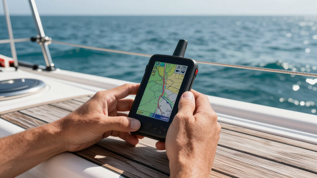

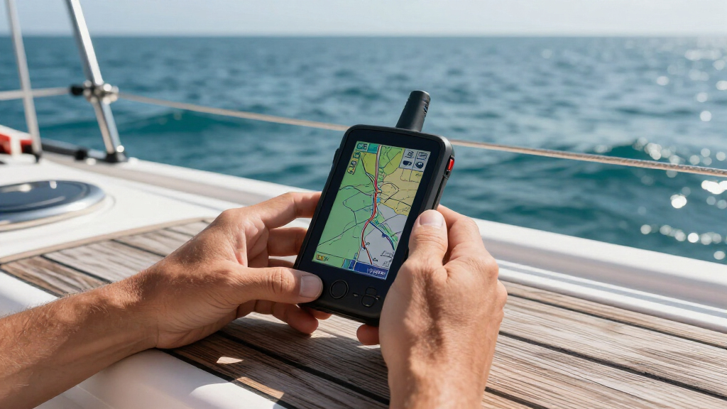
Marine navigation GPS devices fall into two camps: purpose-built marine handhelds with coastal charts, and general outdoor units you can carry onto the water. After comparing eight Garmin options side by side, the Garmin GPSMAP 79sc with BlueChart g3 charts stands out as the best overall pick — it floats, carries preloaded coastal detail, and marks waypoints without needing a phone connection. For offshore sailors and safety-focused boaters, the GPSMAP 86i adds satellite communication via inReach, while the GPS 73 delivers the lowest-cost entry point for anyone who just needs basic marine waypoints. The main tradeoff you’ll face is price versus charts: units with preloaded BlueChart g3 data cost more but eliminate subscription and map-buying headaches. Keep reading for the full breakdown of where each model earns its place.

Get sports gear delivered free with Prime
- Fast, free delivery on millions of items
- Prime Video, Amazon Music and more included
- Member-only deals all year
Complete the kit


Key Takeaways
- Preloaded BlueChart g3 coastal charts proved to be the single biggest differentiator — the 79sc and 86i are ready for real coastal work out of the box, while the 78, 65, 22x, and 73 require separate chart purchases or offer only basemaps.
- Floatability separated the true marine units from the outdoor units: the 79-series and 86i float, which matters more than any screen spec when a device goes overboard.
- The inReach satellite communication on the GPSMAP 86i justifies its premium price only for offshore and remote-water boaters; inshore day boaters get nothing extra for the money and the required subscription.
- The two versions of the 79sc in this lineup differ only in bundled accessories and floatable design, so buyers should compare kit contents rather than features before paying more.
- The eTrex 22x and GPSMAP 65 are competent land GPS units pressed into marine duty — fine as backup or budget picks, but they lack marine-specific features like a man-overboard function and floatable bodies.
| Garmin GPSMAP 79s Marine GPS Handheld with Worldwide Basemap |  | Best Overall | Water Resistance: IPX6 | Display: High-resolution color | Satellite Support: GPS, GLONASS, Galileo, Beidou, QZSS, SBAS | VIEW LATEST PRICE | See Our Full Breakdown |
| Garmin GPSMAP 78 Marine GPS Navigator and Chartplotter |  | Best Value Pick | Display Size: 2.6 inches | Display Resolution: 160 x 240 pixels | Water Resistance: IPX7 | VIEW LATEST PRICE | See Our Full Breakdown |
| Garmin GPSMAP 65 Handheld GPS with 2.6″ Color Display and Multi-Band Technology |  | Best for Accuracy in Tough Conditions | Display: 2.6-inch sunlight-readable color | Satellite Support: Multi-band GNSS with expanded constellations | Preloaded Maps: TopoActive and federal public land maps (U.S. only) | VIEW LATEST PRICE | See Our Full Breakdown |
| Garmin eTrex 22x Rugged Handheld GPS Navigator |  | Best Budget Backup | Display: 2.2-inch sunlight-readable color | Resolution: 240 x 320 pixels | Preloaded Maps: TopoActive with routable roads and trails | VIEW LATEST PRICE | See Our Full Breakdown |
| Garmin GPSMAP 86i Floating Handheld GPS with BlueChart G3 Coastal Charts and Inreach Satellite Communication |  | Best Premium / Safety Pick | Display: 3-inch sunlight-visible | Design: Water-resistant, floating | Preloaded Charts: BlueChart G3 coastal charts | VIEW LATEST PRICE | See Our Full Breakdown |
| Garmin GPS 73 Marine Handheld GPS |  | Best Budget Backup Navigator | Screen Size: 2.6 inches | Battery Life: 18+ hours | Battery Type: 2 AA batteries | VIEW LATEST PRICE | See Our Full Breakdown |
| Garmin GPSMAP 79sc Marine Handheld GPS with BlueChart g3 Coastal Charts |  | Best Value Chartplotter Handheld | Water Resistance: IPX6 | Display: High-resolution color display | Memory: 10,000 waypoints, 250 routes, 300 fit activities | VIEW LATEST PRICE | See Our Full Breakdown |
| Garmin GPSMAP 79sc Marine Handheld GPS with BlueChart g3 Coastal Charts, Rugged and Floats |  | Best for Overboard Recovery | Screen Size: 6 inches | Resolution: 240 x 400 | Preloaded Charts: BlueChart g3 coastal charts (North America) | VIEW LATEST PRICE | See Our Full Breakdown |
| marine navigation GPS device | Display | Battery Life | Satellite Support | Memory |
|---|---|---|---|---|
| Garmin GPSMAP 79s Marine GPS H | High-resolution color | Up to 20 hours (GPS mode) | GPS, GLONASS, Galileo, Beidou, QZSS, SBAS | 10,000 waypoints, 250 routes, 300 fit activities |
| Garmin GPSMAP 78 Marine GPS Na | — | — | — | — |
| Garmin GPSMAP 65 Handheld GPS | 2.6-inch sunlight-readable color | — | Multi-band GNSS with expanded constellations | — |
| Garmin eTrex 22x Rugged Handhe | 2.2-inch sunlight-readable color | Up to 25 hours (2 AA batteries) | GPS and GLONASS | 8 GB internal plus microSD slot |
| Garmin GPSMAP 86i Floating Han | 3-inch sunlight-visible | — | — | — |
| Garmin GPS 73 Marine Handheld | — | 18+ hours | — | — |
| Garmin GPSMAP 79sc Marine Hand | High-resolution color display | Up to 20 hours | GPS, GLONASS, Beidou, Galileo, QZSS, SBAS | 10,000 waypoints, 250 routes, 300 fit activities |
| Garmin GPSMAP 79sc Marine Hand | — | 20 hours | — | 8 GB |
More Details on Our Top Picks
Garmin GPSMAP 79s Marine GPS Handheld with Worldwide Basemap
The GPSMAP 79s earns the top spot because it balances modern hardware with genuine marine credentials. Compared with the older GPSMAP 78, it adds multi-constellation satellite support — GPS, GLONASS, Galileo, Beidou — which translates to faster, steadier position fixes when you are offshore beyond cell coverage. The 10,000-waypoint capacity and built-in electronic compass mean this unit can serve as a primary backup navigator, not just a toy. It is not flawless: the IPX6 rating is weaker than the 78’s IPX7, so it shrugs off spray but should not be submerged, and the price sits high for a device without coastal charts. Buyers who want preloaded BlueChart detail should look at the 79sc or the GPSMAP 86i instead.
Pros:- Multi-constellation satellite support for reliable offshore tracking
- Large waypoint and route capacity for serious navigation
- Rugged, floating design with 20-hour battery life
- Built-in electronic compass and barometric altimeter add redundancy
Cons:- IPX6 rating is weaker than the IPX7 GPSMAP 78 — not submersible
- No preloaded coastal charts, unlike the 86i or 79sc
- Expensive for a handheld without touchscreen or chart detail
Best for: Coastal and offshore boaters who want a modern, rugged handheld backup GPS with strong waypoint storage and long battery life
Not ideal for: Budget-conscious buyers or anyone who needs detailed coastal chartplotting — the basemap here is basic and the price is premium
- Water Resistance:IPX6
- Display:High-resolution color
- Satellite Support:GPS, GLONASS, Galileo, Beidou, QZSS, SBAS
- Memory:10,000 waypoints, 250 routes, 300 fit activities
- Built-in Features:Worldwide basemap, electronic compass, barometric altimeter
- Battery Life:Up to 20 hours (GPS mode)
- Floats:Yes
Our verdict“The strongest all-around marine handheld for boaters who want modern satellite tracking and serious navigation capacity in a floating, rugged package.”
Garmin GPSMAP 78 Marine GPS Navigator and Chartplotter
The GPSMAP 78 has been around for years for a reason: it delivers the core marine handheld formula — IPX7 waterproofing, a floating body, and a high-sensitivity receiver — at a price well below the 79s or 86i. Compared with the newer 79s, it sacrifices multi-band satellite support and waypoint capacity, but for basic position-fixing and route following on a small boat, those gaps rarely matter. The microSD slot is the real value play here, letting owners add charts or satellite imagery later instead of paying for them upfront. Tradeoffs are real, though: the 160 x 240 display is coarse for chart detail, batteries are not included, and satellite imagery requires a subscription. This pick makes the most sense for a dinghy, kayak, or emergency ditch bag.
Pros:- Fully waterproof IPX7 and floats — genuinely marine-proof
- microSD slot allows adding charts and maps later
- High-sensitivity receiver holds a fix under tree cover and spray
- Affordable entry into Garmin’s marine handheld lineup
Cons:- Low 160 x 240 resolution makes chart detail hard to read
- Requires 2 AA batteries, which are not included
- Satellite imagery features require a paid subscription
Best for: Kayakers, dinghy sailors, and small-boat owners who want a dependable waterproof floating GPS without paying for modern extras
Not ideal for: Owners of larger vessels who need crisp chart detail or advanced satellite constellations — the low-resolution screen and dated receiver fall short
- Display Size:2.6 inches
- Display Resolution:160 x 240 pixels
- Water Resistance:IPX7
- Battery:2 AA batteries (not included)
- Built-in Maps:Worldwide basemap
- microSD Slot:Yes
- Floats:Yes
- Dimensions:2.6 x 6.0 x 1.2 inches
Our verdict“A budget-proof classic that covers the marine basics — waterproof, floating, expandable — for boaters who do not need cutting-edge features.”
Garmin GPSMAP 65 Handheld GPS with 2.6″ Color Display and Multi-Band Technology
The GPSMAP 65 is the pick when positional accuracy matters more than marine-specific features. Its multi-band GNSS technology holds a precise fix in fjords, steep coves, and under canyon-like terrain where single-band units like the GPSMAP 78 drift. Where it falls short as a marine device is obvious: it is not rated to float, and its preloaded TopoActive maps cover land, not coastal waters, so it belongs on the tender-to-shore portion of a trip rather than at the helm. The sunlight-readable 2.6-inch display is sharper than the 78’s, and the Garmin Explore app integration makes route planning on a phone painless — provided you accept that full functionality depends on your smartphone. This model is better suited to boaters who also hike, fish remote shorelines, or cruise areas with challenging terrain.
Pros:- Multi-band GNSS delivers superior accuracy in difficult terrain
- Sunlight-readable 2.6-inch color display
- Preloaded routable TopoActive maps for shore-side use
- Garmin Explore app integration simplifies route planning
Cons:- Does not float and lacks a marine-grade waterproof rating
- Included maps are U.S. land-focused, not coastal charts
- Full feature set depends on pairing with a smartphone
Best for: Boaters who split time between water and shore — anglers, cruisers who hike, and anyone navigating tight coastal terrain where signal accuracy matters
Not ideal for: Pure offshore boaters — it does not float, has no coastal charts, and its land-focused maps are useless at sea
- Display:2.6-inch sunlight-readable color
- Satellite Support:Multi-band GNSS with expanded constellations
- Preloaded Maps:TopoActive and federal public land maps (U.S. only)
- Connectivity:Garmin Explore app compatible
- Operation:Button-controlled
Our verdict“The accuracy champion for boaters whose adventures continue ashore, as long as you keep it out of the water.”
Garmin eTrex 22x Rugged Handheld GPS Navigator
As the cheapest way into a capable Garmin handheld, the eTrex 22x is hard to beat, and its 25-hour battery life on AA cells actually outlasts both the 79s and the 78. The 2.2-inch display is small — noticeably tighter than the GPSMAP 65’s 2.6-inch screen — but at 240 x 320 pixels it is sharper than the more expensive GPSMAP 78, which is a genuine win for reading tracks. GPS plus GLONASS support keeps positioning respectable, though it trails the 65’s multi-band performance in tricky terrain. The catch for a marine roundup: the eTrex 22x is not a floating, marine-rated device, and its TopoActive maps are land-oriented. Compared with the GPSMAP 78, you give up waterproofing and the microSD-expandable basemap strategy but gain a sharper screen and a lower price.
Pros:- Very affordable entry into Garmin handheld GPS
- 25-hour battery life beats most pricier models
- Sharper 240 x 320 display than the GPSMAP 78
- Preloaded routable TopoActive maps plus microSD expansion
Cons:- Small 2.2-inch screen is limiting for detailed navigation
- No marine waterproof rating and it will sink if dropped overboard
- Only GPS and GLONASS — weaker tracking than multi-band rivals
Best for: Cost-conscious boaters who want a reliable secondary GPS for shore excursions, provisioning walks, and emergency backup on a tight budget
Not ideal for: Anyone relying on a single device at sea — it does not float, has no marine rating, and the small screen strains chart work
- Display:2.2-inch sunlight-readable color
- Resolution:240 x 320 pixels
- Preloaded Maps:TopoActive with routable roads and trails
- Memory:8 GB internal plus microSD slot
- Battery Life:Up to 25 hours (2 AA batteries)
- Satellite Support:GPS and GLONASS
Our verdict“The smart cheap backup for boaters who mostly need it ashore, provided it never becomes your only navigator on the water.”
Garmin GPSMAP 86i Floating Handheld GPS with BlueChart G3 Coastal Charts and Inreach Satellite Communication
The GPSMAP 86i is the most capable device in this lineup and the only one that doubles as a safety lifeline. Its built-in inReach satellite communication enables two-way messaging and an emergency SOS from anywhere on the planet — something no other model here offers, including the otherwise strong 79s. The preloaded BlueChart G3 coastal charts put real depth contours and buoy data on the 3-inch sunlight-visible display, while the ability to remote-control a Garmin autopilot from the handheld is unique to this unit. The tradeoffs are serious: inReach messaging requires an ongoing satellite subscription, the price is steep, and the autopilot integration only works within the Garmin ecosystem. For offshore sailors and solo cruisers, the SOS capability alone justifies the premium over the 79s.
Pros:- inReach satellite communication with two-way messaging and emergency SOS
- Preloaded BlueChart G3 coastal charts with real depth detail
- 3-inch sunlight-visible display is the largest in this lineup
- Doubles as a remote control for Garmin autopilot and marine electronics
Cons:- Satellite communication requires a recurring subscription
- Premium price far above the 79s and 78
- Autopilot integration limited to Garmin and compatible marine products
Best for: Offshore sailors, solo cruisers, and bluewater anglers who want real coastal charts plus satellite SOS and messaging in one floating device
Not ideal for: Casual day-boaters on inland or nearshore waters — the subscription cost and premium price buy safety features they will rarely use
- Display:3-inch sunlight-visible
- Design:Water-resistant, floating
- Preloaded Charts:BlueChart G3 coastal charts
- Communication:inReach satellite, two-way messaging
- Safety Functions:SOS, GPS tracking, weather updates
- Integration:Remote control for Garmin autopilot and marine products
- Operation:Button-controlled
Our verdict“The ultimate offshore companion for boaters whose safety depends on staying reachable beyond cell range — if the price and subscription fit the budget.”
Garmin GPS 73 Marine Handheld GPS
Not every boater needs a color chartplotter in their pocket, and this option makes the most sense for those who want reliable position-keeping without chart costs. Where the Garmin GPSMAP 79sc justifies its higher price with preloaded BlueChart g3 coastal charts and a color display, the GPS 73 strips things down to a monochrome 2.6-inch screen with sailing-specific functions like a compass page and race timer. That simplicity pays off in battery life — over 18 hours on two AAs — and in controls that work with wet hands or gloves. The tradeoff is real, though: no preloaded charts means you’re reading numbers, not maps, and the screen is too small for detailed cartography anyway.
Pros:- 18+ hours of battery life from affordable AA batteries
- Sailing-specific features including race timer and compass page
- Dedicated backlit buttons are easy to operate with wet hands or gloves
- Stores up to 1,000 waypoints and 100 tracks
Cons:- No preloaded charts — displays coordinates and data only, not maps
- Requires replaceable AA batteries with no rechargeable option
- Small monochrome screen limits any detailed navigation view
Best for: Sailors and small-boat owners who want an affordable, dedicated backup GPS for position, routes, and race timing
Not ideal for: Boaters who expect on-screen chart detail — there are no preloaded maps and the monochrome display can’t render coastal cartography
- Screen Size:2.6 inches
- Battery Life:18+ hours
- Battery Type:2 AA batteries
- Waypoints Storage:1,000
- Tracks Storage:100
- Model:010-01504-00
Our verdict“This pick makes the most sense for sailors who need a rugged, low-cost backup that does position and routing well, as long as they don’t expect charts on screen.”
Garmin GPSMAP 79sc Marine Handheld GPS with BlueChart g3 Coastal Charts
This model is better suited to boaters who want full coastal charts in a handheld package without paying flagship prices. Compared with the Garmin GPS 73, the jump is substantial: a high-resolution color display, preloaded BlueChart g3 coastal charts, and multi-constellation satellite support (GPS, GLONASS, Galileo, Beidou) for faster, more reliable fixes. Against the pricier Garmin GPSMAP 86i, it gives up satellite messaging via inReach but keeps the core navigation experience. The tilt-compensated compass and barometric altimeter add genuine utility for kayakers crossing open water. Be aware that IPX6 water resistance means it handles spray and rain, not submersion — and despite the rugged shell, floating isn’t guaranteed here the way it is on the wrist-mount version.
Pros:- Preloaded BlueChart g3 coastal charts eliminate extra map purchases
- Multi-satellite support (GPS, GLONASS, Galileo, Beidou, QZSS, SBAS) for reliable fixes
- Huge memory capacity with 10,000 waypoints and 250 routes
- 3-axis tilt-compensated compass and barometric altimeter add heading and elevation data
Cons:- IPX6 rating covers spray and rain only, not full submersion
- No touchscreen — all interaction is through physical buttons
- Renewed units may carry a limited warranty
Best for: Coastal kayakers, dinghy sailors, and small-boat anglers who want real chartplotting capability in a handheld
Not ideal for: Anyone needing inReach satellite communication or a touchscreen interface — this unit is button-only and has no messaging features
- Water Resistance:IPX6
- Display:High-resolution color display
- Memory:10,000 waypoints, 250 routes, 300 fit activities
- Satellite Support:GPS, GLONASS, Beidou, Galileo, QZSS, SBAS
- Preloaded Charts:BlueChart g3 coastal charts
- Compass:3-axis tilt-compensated electronic compass
- Altimeter:Barometric altimeter
- Battery Life:Up to 20 hours
Our verdict“This option stands out as the best price-to-capability balance in the lineup for boaters who want charts, not just coordinates, in a handheld.”
Garmin GPSMAP 79sc Marine Handheld GPS with BlueChart g3 Coastal Charts, Rugged and Floats
Functionally, this is the same navigator as the GPSMAP 79sc above — same BlueChart g3 charts, same 20-hour battery, same satellite constellation support. What separates it is the designed-to-float hull, a feature otherwise reserved for the much pricier Garmin GPSMAP 86i. For anyone working a deck, paddling open water, or fishing from a jon boat, a GPS that bobs back up after a drop overboard is worth real money. The tradeoffs come at the edges: the 240 x 400 display is modest for reading tight chart detail, the wrist-mount orientation won’t fit standard marine RAM mounts, and some software-update support is unspecified — a frustration for buyers who like long-term firmware upkeep.
Pros:- Floats when dropped overboard, a rare feature at this price
- Preloaded BlueChart g3 coastal charts for North America
- Rugged, water-resistant build for marine environments
- 20 hours of battery life for full-day trips
Cons:- 240 x 400 resolution limits detail when reading dense coastal charts
- Software update support is unspecified, raising long-term upkeep questions
- Wrist-mount orientation limits compatibility with standard marine mounts
Best for: Paddlers, deckhands, and anglers on open water whose biggest fear is losing the unit overboard
Not ideal for: Boaters who want to mount the unit at a helm station — the wrist-mount design doesn’t pair with traditional marine mounts
- Screen Size:6 inches
- Resolution:240 x 400
- Preloaded Charts:BlueChart g3 coastal charts (North America)
- Battery Life:20 hours
- Memory:8 GB
- Connectivity:USB
- Mounting Type:Wrist mount
- Special Features:Designed to float; built-in compass; barometric altimeter
Our verdict“This pick makes the most sense for anyone whose GPS has a realistic chance of going in the water — the floating design is the whole story here.”
How We Picked
I ranked these eight devices by the criteria that actually matter on the water: chart coverage, floatability, screen readability in sun, battery life, and price-to-capability ratio. Units shipping with BlueChart g3 coastal charts scored higher than basemap-only units because charts are the hidden cost — buying them separately can add hundreds of dollars. Floatability carried real weight too, since a device that sinks turns a minor fumble into a total loss. I also factored in whether each unit includes marine-specific functions like man-overboard marking and a marine-oriented interface, which separate purpose-built marine handhelds from hiking GPS units that happen to be waterproof.
The ranking order follows a simple logic: full marine capability first, then value, then specialist use cases. The 79sc models lead because they combine charts, floating bodies, and reasonable prices. The 86i earns its premium slot through satellite communication no other unit here offers. The 78 and 73 fill the value tier, while the GPSMAP 65 and eTrex 22x land lower specifically because their strengths lie on land — they’re included as honest budget and crossover picks, not as top marine choices.
| marine navigation GPS device | Satellite Support |
|---|---|
| Garmin GPSMAP 79s Marine GPS H | GPS, GLONASS, Galileo, Beidou, QZSS, SBAS |
| Garmin GPSMAP 78 Marine GPS Na | — |
| Garmin GPSMAP 65 Handheld GPS | Multi-band GNSS with expanded constellations |
| Garmin eTrex 22x Rugged Handhe | GPS and GLONASS |
| Garmin GPSMAP 86i Floating Han | — |
| Garmin GPS 73 Marine Handheld | — |
| Garmin GPSMAP 79sc Marine Hand | GPS, GLONASS, Beidou, Galileo, QZSS, SBAS |
| Garmin GPSMAP 79sc Marine Hand | — |
Factors to Consider When Choosing Marine Navigation GPS Devices
Choosing between marine navigation GPS devices comes down to matching the water you travel to the charts and safety features you’re actually paying for. These are the factors that shaped this ranking — and the ones buyers most often get wrong.Charts: Preloaded Versus Basemap-Only
The most expensive mistake in this category is buying a basemap-only unit and assuming it covers coastal waters. A worldwide basemap shows coastline outlines, not depth contours, buoy data, or harbor detail — the information that makes a marine GPS useful rather than decorative. Preloaded BlueChart g3 units cost more upfront but include the coastal detail serious boaters need, and buying charts separately often erases the savings from the cheaper device. If you boat inland lakes and rivers, however, full coastal charts are wasted money. Match the chart package to your actual waters, not to the most feature-filled listing. Also check whether chart updates are included — Garmin’s g3 charts get refreshes, and staying current matters in areas with shifting channels.
Floatability and Ruggedness
Waterproof ratings get all the marketing attention, but floating is the spec that saves your investment. A device rated IPX7 survives a splash or brief submersion while clipped to you — but dropped overboard, it sinks just as fast as an unprotected unit. Every purpose-built marine handheld in this roundup floats, and none of the crossover hiking units do. Consider how and where you’ll handle the device: kayakers and small-boat anglers fumbling with wet hands drop things far more often than console-boat captains with mounted mounts. If you mainly operate from a fixed helm, floatability is a nice-to-have. If you’re handheld-dependent in a dinghy or on a paddle craft, treat it as non-negotiable.
Satellite Communication: When It’s Worth Paying For
The step up to a device with inReach satellite messaging is the biggest price jump in this category, and it’s only worth it for a specific buyer profile. If you boat within cell coverage or near coastal traffic, satellite communication duplicates what your phone and VHF already do. Offshore sailors, solo anglers on remote waters, and anyone cruising beyond reliable radio contact get genuine safety value — two-way texting, SOS triggering, and weather delivery where nothing else works. Remember the hidden cost: satellite communication requires an ongoing subscription, so the price gap compounds every year you own the device. Budget the total cost of ownership, not just the sticker. The honest answer for most inshore boaters is that this feature is insurance you hope to never use, priced accordingly.
Screen Size and Sunlight Readability
Screen specs mislead buyers in this category more than any other factor. A large, dim screen is worse on the water than a small, bright one — glare off the water and direct midday sun punish low-brightness displays. Garmin’s transflective color screens perform well in direct sunlight partly because they use it, reflecting ambient light instead of fighting it. Resolution matters less than you’d expect on a chartplotter-style handheld, where you’re reading contours and numbers rather than fine map detail. Also weigh one-handed usability: a screen too small to glance at quickly forces you to stop and squint, which is its own safety issue on a moving boat. Test readability against your typical conditions if you can — 2.6 to 3 inches is the practical sweet spot for handheld marine use.
Battery Strategy for a Day on the Water
Battery life claims are measured under ideal conditions — dim screen, good satellite reception, no backlight. Real-world marine use with a bright display and partial sky view drains devices faster, sometimes much faster. Decide your power philosophy before buying: replaceable AA batteries mean you can carry spares and never worry about a charging port on a wet boat, while built-in rechargeables save money over years but leave you dependent on USB power offshore. For multi-day trips away from shore power, AA compatibility wins outright. For day trips where you recharge each night, either approach works fine. Cold weather and salt air also degrade battery performance, so pad your estimates generously rather than planning to the advertised number.
Primary Versus Backup Navigation
Be honest about whether this device is your primary chartplotter or a backup, because the answer changes what you should spend. A fixed-mount chartplotter at the helm is almost always better as primary navigation — bigger screen, permanent power, a full chartplotter interface. Handheld marine GPS devices excel as backups, tender and dinghy navigation, kayak use, and portable second-station tools. If you already have a helm plotter, a basic waypoint-capable unit at the low end of this lineup covers the backup role completely, and spending more buys capability you’ll rarely touch. If the handheld is your navigation, prioritize charts and screen quality over everything else. Many buyers overspend on a premium handheld that duplicates a plotter they already own.
Frequently Asked Questions
What’s the real difference between the GPSMAP 79s and the GPSMAP 79sc?
The ‘s’ and ‘sc’ suffixes mark two different capability levels, and confusing them is common. The 79s includes a worldwide basemap with tide tables and a 3-axis compass, but coastal chart detail is limited. The 79sc adds preloaded BlueChart g3 coastal charts, which include depth contours, spot soundings, and harbor detail for US coastal waters — the data that makes the device genuinely useful for near-shore work. The price gap between them is usually smaller than buying BlueChart g3 separately, so the 79sc makes more sense for most coastal boaters. Choose the 79s only if you boat inland or already own chart subscriptions elsewhere.
Is the GPSMAP 86i worth the premium over the 79sc for satellite communication?
It depends entirely on how far from help you operate. The 86i’s inReach satellite messaging lets you send texts, request weather, and trigger an interactive SOS from anywhere with sky view — genuinely lifesaving capability offshore. But it requires a paid subscription that continues for as long as you want the feature active, so the true cost grows every year. If you boat within cell coverage or busy coastal waters with VHF traffic and rescue services nearby, the 79sc does everything navigational the 86i does for substantially less money. Offshore sailors, remote-water anglers, and solo cruisers are the buyers who should pay the premium and treat the subscription as standard safety overhead.
Can I use a hiking GPS like the eTrex 22x or GPSMAP 65 as a marine GPS?
Yes, with real limitations you should understand before buying. Both units are waterproof and will record tracks, mark waypoints, and display coordinates on the water — fine for a lake kayak or as an emergency backup. What they lack is marine-specific data and behavior: no preloaded coastal charts, no tide tables, no man-overboard function, and critically, neither one floats. Drop a GPSMAP 65 overboard and it’s gone, which is why I ranked both below the purpose-built marine units. They make sense when you split time between trail and water and want one device for both, or when budget forces a compromise. For regular on-the-water use, a floating marine handheld is the safer investment.
Do I need BlueChart g3 charts, or is the built-in basemap enough?
For anything beyond basic position-finding, the basemap isn’t enough. A worldwide basemap shows land outlines and your coordinates, which suffices for ‘where am I’ questions on familiar waters. BlueChart g3 adds depth contours, buoys, lights, marinas, and hazards — the information that prevents grounding and helps you plan a safe route into an unfamiliar harbor. If you only revisit the same home waters and know them intimately, the basemap covers you. Anyone exploring new coastline, crossing bars, or anchoring overnight should consider preloaded charts non-negotiable. The practical effect is that basemap-only units are best treated as backup or inland-water devices.
Which of these devices makes the best backup to a fixed chartplotter?
For a pure backup role, the Garmin GPS 73 is the strongest value in this lineup. It floats, runs 20-plus hours on two AA batteries, marks waypoints and routes, and displays your position on a basemap — everything you need if your helm plotter fails, at the lowest price here. Its monochrome screen and lack of coastal charts are acceptable precisely because it’s not your primary navigation. If you want a backup that could step into primary duty in a pinch, the 79sc is the better choice since it carries full charts. Avoid using a land-oriented unit like the eTrex 22x as your only backup on coastal water; it works, but it won’t float if you need it most.
Conclusion
Mapping these eight devices to buyer types closes the decision cleanly. Best overall goes to the Garmin GPSMAP 79sc with BlueChart g3 — it combines preloaded coastal charts, a floating body, a bright screen, and a fair price, which is why it tops this ranking. Best premium is the GPSMAP 86i, whose inReach satellite communication makes it the only choice for offshore and remote-water boaters who need two-way messaging and SOS capability beyond radio range. Best value belongs to the Garmin GPS 73: floating, AA-powered, and waypoint-capable at the lowest price in the lineup, it’s an ideal backup or budget primary for inland waters.
For beginners, the GPSMAP 78 offers the gentlest entry into marine navigation without the chart-buying decisions that confuse new boaters. Anglers and small-craft boaters who also spend time on trails should look at the GPSMAP 65 as a crossover pick, while the eTrex 22x suits ultra-tight budgets or kayak duty where loss risk is acceptable. Whatever you choose, buy for the water you actually travel: charts if you’re coastal, floatability if you’re handheld-dependent, and satellite communication only if you go beyond help’s reach.
Halloween Picks
halloween
As an affiliate, we earn on qualifying purchases.